
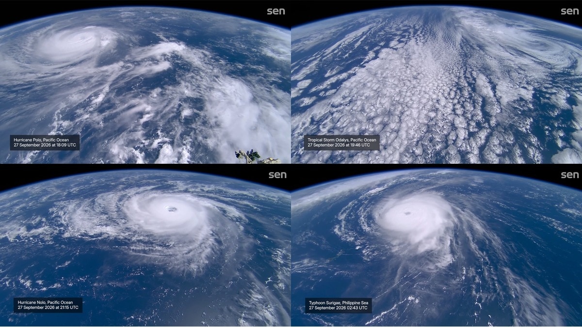
Four storms, thousands of kilometres apart, were churning across the Pacific on September 27. Here's what is happening on the ground.Satellites in space captured multiple storms churning in the Pacific. (Photo: X/@sen)New Delhi,Sep 29, 2026 16:08 ISTA view from space has captured just how busy the Pacific Ocean became in late September, with four tropical systems spinning across the ocean at the same time.Footage captured from a camera aboard the International Space Station (ISS) from September 27 shows Hurricane Nolo, Hurricane Polo, Tropical Storm Odalys and Typhoon Surigae spread across the vast Pacific, their swirling cloud bands visible from orbit.The view demonstrates how enormous tropical weather systems can look when seen from above.FOUR STORMS, ONE OCEANHurricane Nolo, one of the eastern Pacific systems visible in the footage, formed on September 13 and strengthened into a hurricane as it moved across the Pacific towards Hawaii. By September 27, it was packing maximum sustained winds of about 185 kmph and was positioned south of Honolulu, Hawaii, before moving farther away from the islands.Meanwhile, Hurricane Polo developed around September 20 and underwent an extraordinary period of rapid intensification, reaching Category 5 strength, with peak winds of about 285 kmph. It then weakened as it headed towards Mexico. Tropical Storm Nolo (left), Hurricane Odalys (middle), and Hurricane Polo (right), are seen in the Pacific. (Photo: AP/Noaa) By Tuesday, September 29, Polo had made landfall in Baja California Sur as a Category 2 hurricane, bringing the threat of destructive winds and flash flooding.Tropical Storm Odalys also formed around September 20 in the eastern Pacific and briefly strengthened into a hurricane. But by September 27, it was rapidly weakening and was expected to become post-tropical.Odalys eventually lost its tropical characteristics, making it no longer an active tropical storm by September 29.Farther west, Typhoon Surigae was churning in the western Pacific after developing east of the Philippines. It strengthened rapidly and became a very strong typhoon as it moved towards the waters around Okinawa and Japan.On September 29, it remained a powerful system south of Japan but was beginning to weaken as it moved east-northeast.WHY DID MULTIPLE STORMS APPEAR TOGETHER?September is typically one of the busiest periods of the Pacific tropical cyclone season.Warm ocean waters provide the heat and moisture needed to fuel tropical cyclones, while favourable atmospheric conditions can allow several systems to develop across different parts of the ocean at roughly the same time.The September 27 Pacific Disaster Center snapshot showed all four systems simultaneously active across the Pacific, although they were at very different stages of development.The satellite image may make the four systems look equally imposing, but they were not.Nolo and Polo were hurricanes in the eastern Pacific, Surigae was a powerful typhoon in the western Pacific, while Odalys was already weakening rapidly. People evacuate their homes as Hurricane Polo approaches. (Photo: AP) WHAT IS HAPPENING NOW?The situation changed quickly after September 27.Polo has since crossed Baja California Sur, Mexico, as a Category 2 hurricane; Nolo has continued moving away from Hawaii and Odalys has faded into a post-tropical system.Surigae, meanwhile, remains the major system to watch in the western Pacific, as it continues moving east-northeast south of Japan and is expected to weaken as it encounters less favourable conditions.Seen from space, however, the September 27 snapshot captured nature's fury in a breathtaking view of four named Pacific systems, thousands of kilometres apart, spinning simultaneously across one of Earth's largest oceans.- Ends
Watch: Four giant storms seen raging in Pacific Ocean from Space Station
Full Article
Original Source
Read the full article at Indiatoday →KhanList aggregates and links to publicly available news content. We do not host full articles from third-party sources. Always verify important information with original sources.