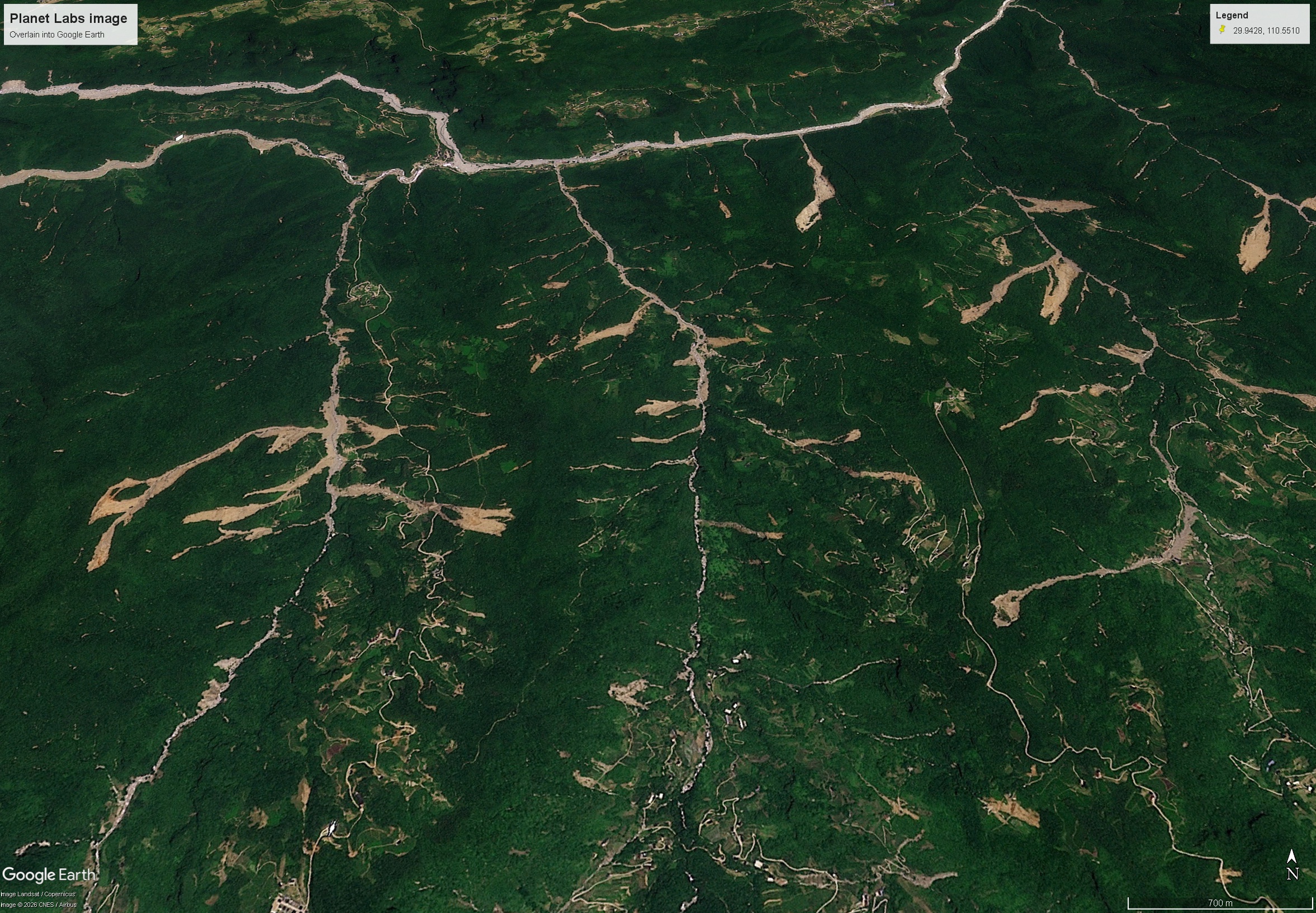
Planet Labs image of the smaller May 2026 landslides in Shimen County, China. Image copyright Planet Labs, used with permission, draped onto the Google Earth DEM. Satellite images show two very large landslides and multiple smaller failures, and channelised debris flows, in Shimen County in China. In China, this year rainy season started with an intense event that covered the provinces of Guizhou, Hubei and Hunan in the period between 17 and 21 May 2026. There were some news reports at the time, although the story disappeared quite quickly. One area that was seriously affected was Enshi Tujia and Miao autonomous prefecture, which I have highlighted previously. However, news reports also suggested a major impact in Shimen County in Hunan Province, which impacted 23 townships with 103,247 residents were affected. One news report indicates that about 340 mm of rain fell in 24 hours. There was some imagery of the aftermath of landslides. One article from Hong Kong reports 16 dead and missing in this area. Planet Labs has now managed to capture some good imagery of the aftermath of the rainfall event in Shimen County. The area affected is around: [29.9428, 110.5510]. Planet Labs captured an image on 27 June 2026 using their PlanetScope instruments:- Planet Labs image of the May 2026 landslides in Shimen County, China. Image copyright Planet Labs, used with permission, draped onto the Google Earth DEM. There are two very large landslides in the image (and highlighted below). The one with the marker is about 3.5 km from the crown to the main drainage line, although one could argue that the runout distance is about another kilometre beyond that point. Note that the image shows that this landslide was valley-blocking and that a small lake has developed. There is a Sentinel image from 23 July 2026 that shows that this lake was still intact. Planet Labs image of one of the May 2026 landslides in Shimen County, China. Image copyright Planet Labs, used with permission, draped onto the Google Earth DEM. The other large landslide, also seen in the above image, is about 3 km long and 450 m wide. Elsewhere there are many smaller landslides, although some of these are over a kilometre in length:- Planet Labs image of the smaller May 2026 landslides in Shimen County, China. Image copyright Planet Labs, used with permission, draped onto the Google Earth DEM. It is notable that these landslides have generated very serious channelised debris flows in the main drainage lines, which appear to have extended over a distance of many kilometres. There is evidence of severe damage to the infrastructure in the channels. This intense cluster of landslides occurs in an area of about 20 km x 7 km. Clearly, in this zone there must have been very exceptional rainfall, greater than in adjacent areas. Acknowledgement Many thanks to Planet Labs for use of the imagery. Text © 2026. The authors. CC BY-NC-ND 3.0Except where otherwise noted, images are subject to copyright. Any reuse without express permission from the copyright owner is prohibited.
The 17-21 May 2026 landslides in Shimen County, Hunan, China
Full Article
Original Source
Read the full article at Eos →KhanList aggregates and links to publicly available news content. We do not host full articles from third-party sources. Always verify important information with original sources.