
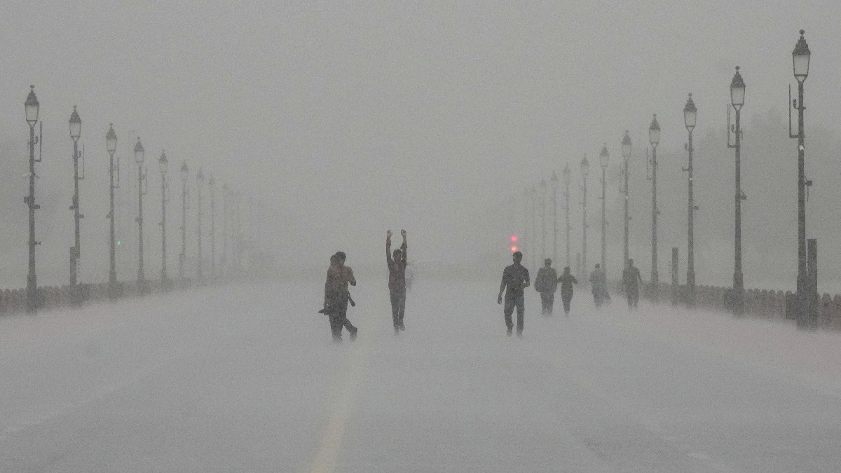
Delhi-NCR woke up to wet skies on Saturday after a sharp burst of rain the day before, on Friday, left streets and the airport dealing with water.The sustained spell of intense rain and winds and storms has prompted the question about what is keeping the rain coming?The simple answer is that it has to do with more than just the monsoon. A rain-soaked Kartavya Path following heavy downpour in New Delhi. (Photo: PTI) INTENSE RAIN ARRIVED IN DELHI-NCR Heavy rain hit the capital on September 4, particularly during the afternoon.Strong, gusty winds accompanied the showers, reaching 50 kmph at Safdarjung and 30-60 kmph at Palam between 3:30 pm and 5 pm. Palam recorded 75.6 mm of rain between 8:30 am and 5:30 pm, while Safdarjung recorded 32.6 mm, Lodhi Road 34.6 mm and Ridge 20 mm during the same period. Vehicles ply on a road amid heavy rain, in Noida. (Photo: PTI) Gurgaon also recorded 44.5 mm between 8:30 am and 5:30 pm.The heavy showers brought waterlogging to parts of Delhi and disrupted conditions around the airport.WHY IS IT RAINING HEAVILY IN DELHI-NCR?A well-marked low-pressure area over northwest Madhya Pradesh and adjoining southwest Uttar Pradesh, along with several other weather systems, is helping keep conditions favourable for rain and thunderstorms over Delhi-NCR.The system is expected to remain nearly stationary for the next 24 hours. A satellite image shows the weather systems and monsoon trough over India. (Photo: Windy) Furthermore, the well-marked low-pressure area is only one part of the picture.The monsoon trough currently passes through the centre of this system before extending eastwards towards Tripura.Another trough stretches from northeast Rajasthan to Manipur, while a third extends from south Gujarat to Jharkhand.A western disturbance is also present as a trough in the middle and upper levels of the atmosphere. Vehicles wade through a waterlogged road following rainfall, in New Delhi. (Photo: PTI)Â Together, these weather features are helping maintain an active spell over the region.WILL IT RAIN AGAIN?Saturday is unlikely to offer any change from the wet spell, with forecasts showing September 5 likely to remain wet.The IMD forecasts one or two spells of light to moderate rain with thunderstorms and lightning at many places, with heavy rain possible at isolated places during the morning to forenoon.Another spell of rain and thunderstorms is possible in the afternoon and evening. The maximum temperature is expected to remain around 29-31°C.Rain should ease considerably on Sunday, September 6, with only very light to light rain possible at a few places from morning to afternoon.From September 7 onwards, the IMD forecasts partly cloudy skies and no rain in Delhi.So, while the monsoon is still playing its part, Delhi-NCR's intense rain is being fuelled by a combination of weather systems, making Saturday another day to watch the skies closely.- EndsPublished On: Sep 5, 2026 10:12 IST
What's behind the intense rain hitting Delhi-NCR? It's not just monsoon
Full Article
Original Source
Read the full article at Indiatoday →KhanList aggregates and links to publicly available news content. We do not host full articles from third-party sources. Always verify important information with original sources.