
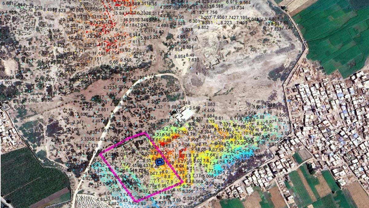
Beneath the ancient Egyptian city of Buto in the Nile Delta, archeologists have uncovered the remains of a massive structure that may have once served as a religious complex more than 2,600 years ago. The discovery offers another glimpse into a settlement that was once an important religious center in Lower Egypt with a mysterious period of abandonment in its history. A team of Egyptian researchers made the discovery using a combination of satellite radar imagery and electrical resistivity tomography, a non-invasive technique that uses electrical currents to map underground structures. The findings, published in the Acta Geophysica journal, offer a rare look into a previously inaccessible layer hiding beneath Egypt’s ancient settlements. An ancient city Buto, known today as Tell al-Fara’in (or the mound of the pharaohs), is one of the most historically significant archeological sites in the Nile Delta. It once served as a major religious and political center of ancient Lower Egypt, with a history stretching back more than 5,000 years. The settlement was associated with the worship of Wadjet, the cobra goddess who served as the protector of Lower Egypt and its rulers. The ancient city remained an important religious center throughout much of Egypt’s history, although the city was largely unoccupied for roughly 1,500 years before it was resettled. Because Buto was inhabited across several different periods, later buildings and accumulated cultural deposits buried older archeological remains. Some of those remains lie beneath thick layers of clay and silt, with parts of the archeological deposits extending below the groundwater level. This makes conventional excavation at greater depths considerably more difficult. To overcome these obstacles, the researchers behind the recent discovery turned to satellite imagery. Using the European Space Agency’s Sentinel-1 satellite, they looked for patterns in the ground that could indicate buried archeological structures. Their analysis revealed a large, oval-shaped anomaly beneath a mound called Kom C. The anomaly measured approximately 420 feet long and 203 feet wide (128 by 62 meters). This helped researchers identify an area for closer investigation using electrical resistivity tomography, which allowed them to build a more detailed picture of what lay beneath the surface. The next step was to conduct a geophysical survey, laying out 15 parallel survey lines. Along these lines, they inserted hundreds of metal electrodes into the ground and connected them to a multi-electrode measuring system. By sending electrical currents through the ground and measuring the resulting voltage differences, researchers were able to create models of the buried landscape. The scans revealed several layers of archeological remains, including a prominent mudbrick wall buried 10 to 20 feet (3 and 6 meters) below the surface. They also found a deeper sand layer that may have served as an artificial foundation for the structure. Buried structure To confirm what appeared in the scans, the researchers then excavated a 33-by-33 foot (10-by-10-meter area) that was around 20 to 23 feet (6 to 7 meters) deep. They uncovered several mudbrick walls resting on the sand layer, as well as different objects associated with religious practices. The objects included amulets depicting Egyptian deities, including Wadjet, and a small offering basin. This suggests that the complex may have served as a secondary temple; it may have also been a religious service complex, a priestly residence, or even a funerary structure. Further excavation will be needed to establish its precise function. The researchers estimate that the complex dates to either the late eighth century BCE or the Saite period (the 26th Dynasty), which ruled Egypt during the seventh and sixth centuries BCE. Researchers believe Buto was largely abandoned after the Old Kingdom and remained unoccupied as a settlement for approximately 1,500 years. It was eventually resettled during the Third Intermediate Period. By the Saite period, the settlement was once again experiencing considerable activity. This newly investigated structure provides further evidence of that period of renewed activity and suggests that parts of the ancient settlement may still be hiding substantial religious or administrative buildings beneath later archaeological layers.
Satellite Imagery Reveals a 2,600 Year-Old Complex Buried Beneath an Ancient City in Egypt
Full Article
Original Source
Read the full article at Gizmodo →KhanList aggregates and links to publicly available news content. We do not host full articles from third-party sources. Always verify important information with original sources.