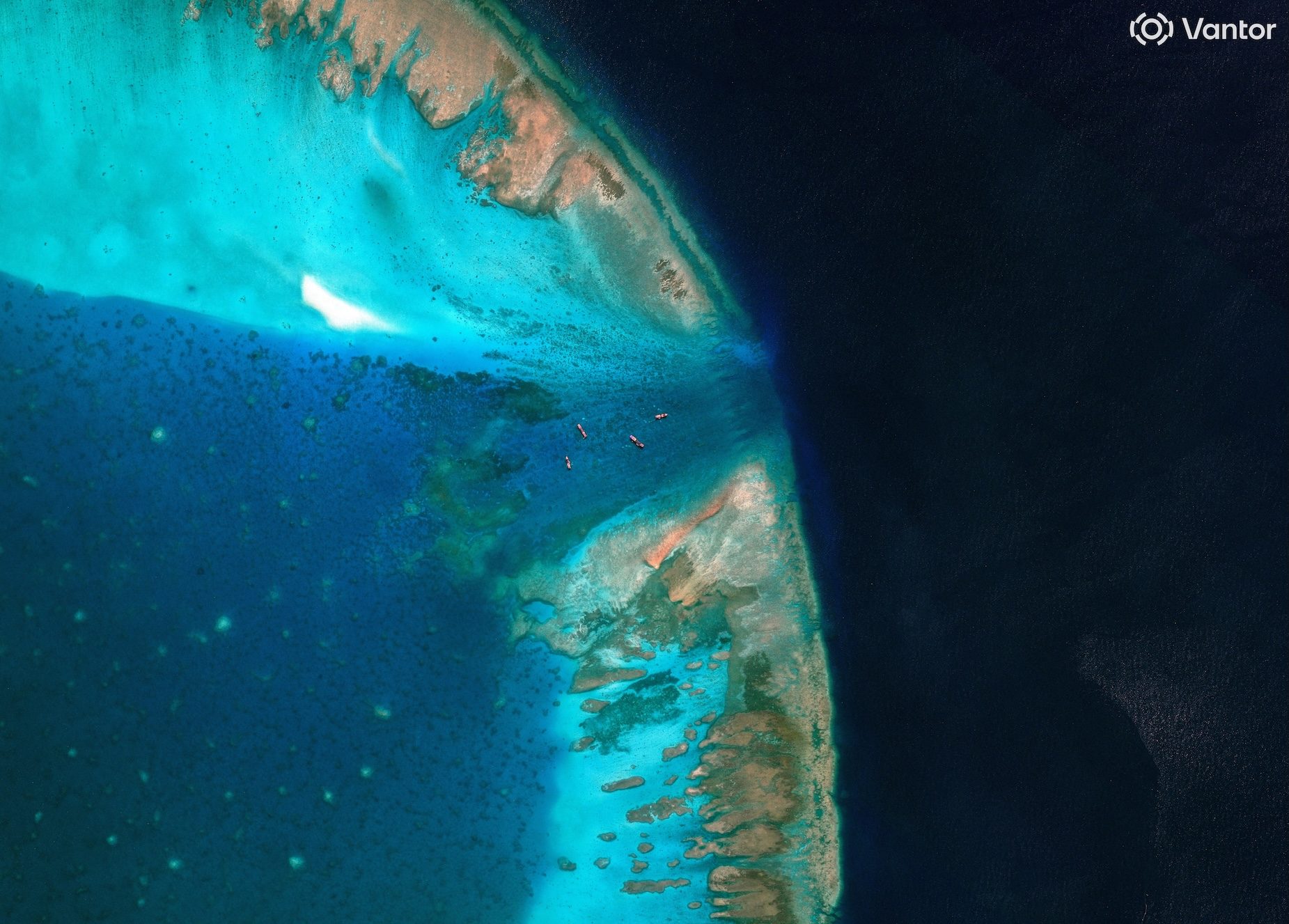
BLOCKED. A satellite image of fishing vessels at the entrance, which is blocked by a floating barrier, to the disputed Scarborough Shoal, in the South China Sea, April 11, 2026. Vantor/Handout via Reuters China has controlled access to the shoal since 2012, following a tense standoff between Manila and Beijing MANILA, Philippines — The Philippines on Wednesday, July 29 (in New York) submitted before the United Nations its official nautical chart of Bajo de Masinloc (Scarborough Shoal), feature in the West Philippine Sea that’s been controlled by China since 2012. Depositing the Philippines’ official nautical chart of the high-tide elevation, said the Department of Foreign Affairs (DFA), “ensures that its official maritime information forms part of the public international record.” The submission of the National Mapping and Resource Information Authority (NAMRIA)-prepared official nautical chart and the shoal’s maritime zones were made before the United Nations Secretariat. The chart, said the DFA, shows the normal baselines of the shoal, as well as the outer limits of its territorial sea and contiguous zone, based on United Nations Convention on the Law of the Sea (UNCLOS) and domestic law. “By depositing the chart, the Philippines formally notifies the international community of its normal baselines and the geographic extent of its applicable authority and jurisdiction at Bajo de Masinloc. The deposit also strengthens transparency and legal certainty by making the Philippines’ official hydrographic information publicly available through the United Nations in accordance with UNCLOS,” said the DFA. Bajo de Masinloc, also known as Scarborough or Panatag Shoal, is a high-tide elevation that the Philippines claims as part of its territory. In both international and domestic law, the feature has a 12 nautical mile territorial sea from its baselines and a contiguous zone that extends between 12 to 24 nautical miles. China’s Ministry of Foreign Affairs, in a statement on July 31, said it rejects the Philippines’ latest actions before the UN. Access to the shoal has been controlled by Beijing since 2012, following a tense standoff between the Philippines and China. It’s that standoff which prompted the then-Aquino administration to bring China to court to clarify its entitlements based on UNCLOS in 2013. Three years later, just at the start of the Rodrigo Duterte administration, the Philippines won their case in the landmark 2016 Arbitral Award, which, among other things, deemed China’s sweeping claim over the South China Sea invalid. Beijing has refused to accept the award, which should be final and binding. The tribunal did not decide on the sovereignty of Bajo de Masinloc, since territorial claims were not part of its jurisdiction. But the tribunal did find that the shoal was traditional fishing ground for Filipino, Chinese, and Vietnamese fisherfolk — which means they should have access to the shoal, no matter who has sovereignty or control over it. This has not been the case since 2012. Several Chinese vessels, including those of the China Coast Guard (CCG), are fixtures at the sole opening of the shoal and the areas surrounding it. The CCG and its auxiliary Chinese Maritime Militia have routinely harassed Philippine ships that come close to the shoal with dangerous manuevers and the use of water cannons. The DFA, in a statement, said depositing the chart also “carries particular significance in the face of climate change and sea-level rise.” “As coastlines and marine environments evolve, the preservation of official nautical charts and baseline information with the United Nations contributes to a permanent and internationally recognized legal record of maritime entitlements established in accordance with international law,” it said. – Rappler.com How does this make you feel? Loading
Philippines deposits Bajo de Masinloc chart before UN
Full Article
Original Source
Read the full article at Rappler →KhanList aggregates and links to publicly available news content. We do not host full articles from third-party sources. Always verify important information with original sources.