
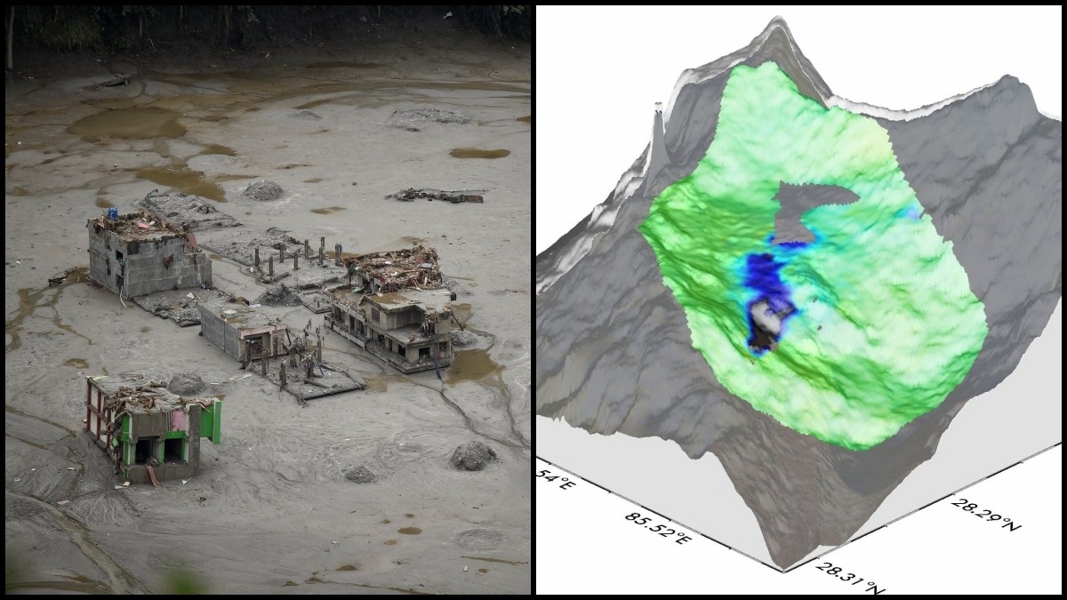
Nisar radar data recorded marked deformation on a Nepal-Tibet Himalayan slope before the 2026 ice-rock avalanche. The observations highlight the potential for cross-border satellite monitoring to support early hazard checks.The deformation was focused on the steep upper slope rather than being spread evenly across the surrounding terrain. (Photo: Reuters/Nisar)The Nasa-Isro Synthetic Aperture Radar (Nisar) mission had captured striking evidence of ground deformation in the weeks leading up to the devastating 2026 ice-rock avalanche in the Nepal-Tibet Himalayan region, offering a glimpse of how space-based radar could help identify dangerous mountain slopes before catastrophic collapse.New analysis using Synthetic Aperture Radar pixel-offset tracking revealed cumulative movement at the precise location where the ice-rock mass eventually gave way.The observations, shared by Zenjiang Liu, a PhD student at Chang'an University, show that the steep mountain slope had been undergoing significant deformation before the collapse, indicating severe stress building within the unstable rock and ice shelf. The radar measurements highlight multiple metres of displacement concentrated in the eventual source area of the avalanche.Three-dimensional visualisations further show how the deformation was focused on the steep upper slope rather than being spread evenly across the surrounding terrain. That concentration of motion is particularly significant because it points to a potentially detectable warning signal before major slope failures.The 2026 collapse triggered a destructive flood disaster downstream, affecting areas across the Nepal-Tibet region. The event demonstrated how a failure high in the Himalayas can rapidly transform into a much larger hazard as ice, rock and debris enter river valleys, potentially creating floods and threatening communities located far from the original collapse zone.Nisar's observations demonstrate the potential value of frequent radar monitoring in some of the world's most hazardous mountain environments. An arial view shows uildings near Trishuli River damaged and covered in mud following deadly flash floods and a mudslide, in Betrawati Bazaar in Rasuwa district, Nepal. (Photo: Reuters) Unlike optical satellites, radar systems can collect observations through clouds and do not depend on daylight, making them especially valuable for monitoring remote Himalayan regions where persistent cloud cover and extreme terrain can limit conventional satellite imaging.SAR pixel-offset tracking works by comparing radar images collected at different times and measuring how features on the ground have shifted. In this case, the technique detected substantial cumulative movement in the weeks before the ice-rock avalanche.Scientists say such capabilities could eventually help create a new layer of early warning for high-risk mountain regions.However, detecting deformation alone does not mean that every moving slope will collapse.Researchers would still need repeated observations, geological analysis and ground-based monitoring to determine whether a particular slope poses an immediate danger.The findings nevertheless strengthen calls for systematic monitoring of unstable mountain landscapes.Experts argue that satellite-based deformation data for high-risk areas should be routinely collected, openly accessible and shared between governments, particularly in regions where hazards cross national borders.The Nisar observations provide a powerful example of what may be possible: spotting severe stress on a mountain slope from space before disaster strikes, and potentially giving authorities valuable time to investigate and prepare.- EndsPublished By: Sibu Kumar TripathiPublished On: Sep 1, 2026 12:40 IST
Nisar sent clear warning signs before deadly Nepal ice-rock avalanche
Full Article
Original Source
Read the full article at Indiatoday →KhanList aggregates and links to publicly available news content. We do not host full articles from third-party sources. Always verify important information with original sources.