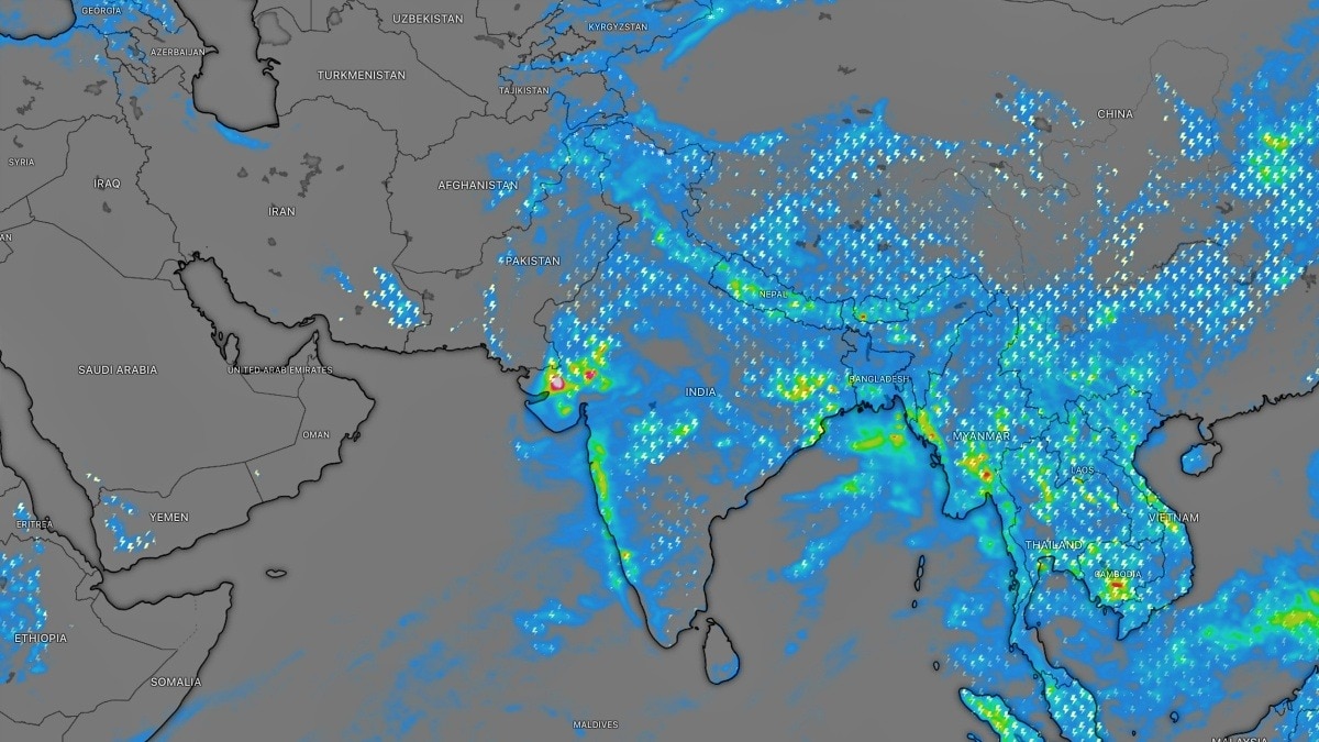
The southwest monsoon will keep lashing Gujarat as a stalled low-pressure system remains in place. The stationary circulation is sustaining repeated thunderstorms and raising the risk of flooding.IMD has warned of isolated exceptionally heavy rainfall over Gujarat. (Photo: Windy)The southwest monsoon is set to continue battering Gujarat for at least another 24 hours as a stubborn low-pressure system over western India refuses to move, keeping the state under the threat of exceptionally heavy rainfall, flooding and thunderstorms.Satellite images from ISRO's INSAT-3DR show a massive swirl of dense rain-bearing clouds anchored over Gujarat and the northeastern Arabian Sea.Weather radar and lightning maps indicate intense thunderstorm activity continuing across the region, with fresh rain bands repeatedly sweeping inland from the sea.The India Meteorological Department (IMD) has warned of isolated exceptionally heavy rainfall over Gujarat on July 24 and 25, while the Gujarat region and Saurashtra and Kutch are likely to witness widespread rainfall over the next several days. Thunderstorms accompanied by lightning are also expected across the state through July 27.WHY ISN'T THE MONSOON SYSTEM MOVING? Meteorologists say the prolonged spell is being driven by a slow-moving low-pressure circulation that has become trapped between larger atmospheric weather patterns.Normally, such monsoon systems travel steadily westward or northwestward, carrying rain to new regions. However, in this case, weak steering winds in the middle levels of the atmosphere have prevented the circulation from progressing.As a result, the system has remained nearly stationary over Gujarat, continuously drawing warm, moisture-laden winds from the Arabian Sea.This uninterrupted supply of moisture is fuelling repeated rounds of deep convection, where towering thunderclouds develop over the same areas again and again.The phenomenon, often referred to as "training" thunderstorms, causes successive rain cells to pass over the same locations, dramatically increasing rainfall totals and flood risk.The active monsoon trough, extending across northern India, has further strengthened the circulation, while warm Arabian Sea waters continue supplying abundant moisture to the system.HEAVY RAIN TO CONTINUEAccording to the IMD, fairly widespread to widespread rainfall is expected over Gujarat from July 24 to 28, with Saurashtra and Kutch likely to receive widespread rain through July 26. Heavy to very heavy rainfall is forecast over the Gujarat region on July 24-27, while isolated pockets could receive exceptionally heavy rainfall during the first two days of the forecast period.The active monsoon will also affect Konkan and Goa through July 30 and Madhya Maharashtra over the next several days, where heavy to extremely heavy rainfall has also been forecast.With rivers already swollen and reservoirs filling rapidly after days of relentless rain, authorities have urged residents in low-lying areas to remain vigilant.Until the low-pressure system finally weakens or begins moving inland, Gujarat is expected to remain under the grip of one of the season's most persistent and intense monsoon spells.- EndsPublished By: Sibu Kumar TripathiPublished On: Jul 25, 2026 07:00 IST
Monsoon to pummel Gujarat for 24 hours: Why is the rain not stopping?
Full Article
Original Source
Read the full article at Indiatoday →KhanList aggregates and links to publicly available news content. We do not host full articles from third-party sources. Always verify important information with original sources.