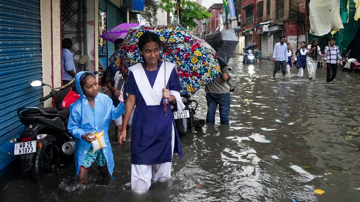
After a patchy and weaker-than-usual start to the 2026 southwest monsoon, the rains are finally picking up pace across large parts of India.Low-pressure systems and an active monsoon trough are bringing widespread showers, thunderstorms, and heavy downpours that could last through the coming week. Commuters wade through a waterlogged road following heavy rain. (Photo: PTI) WHAT WILL REVIVE THE MONSOON?The India Meteorological Department (IMD) points to fresh low-pressure areas as the main drivers.One had formed over southwest Rajasthan, fuelling extremely heavy rain in Gujarat and parts of Maharashtra. Now another has begun to stir over the Bay of Bengal and adjoining West Bengal coast.The formation of this new system is expected to trigger heavy to very heavy rainfall in Odisha and nearby eastern regions from July 25-28. A satellite image illustrated to highlight two low pressure systems. (Photo: Windy) These systems pull in moist air from the Arabian Sea and Bay of Bengal, feeding the monsoon trough, which is the imaginary line where monsoon winds converge.When the trough shifts or strengthens, as it has now, it leads to organised rain spells. This revival comes after a subdued phase earlier in July, when many areas saw below-normal activity.Cumulatively, since the arrival of monsoon on June 4, the country is still running a rainfall deficit. Street vendors sell hats and hand fans on a humid July morning. (Photo: PTI) AN UNEVEN MONSOON SEASONIt's safe to say that this monsoon season has been entirely uneven, facing long humid and dry spells and then intense downpours for short durations.The monsoon arrived under a developing El Nino influence, resulting in a slow and deficient June with rainfall significantly below average in many central and western regions.Early July brought intense spells, such as a well-marked low-pressure area that lashed Gujarat, Odisha, Konkan, and parts of Maharashtra with extremely heavy rain, causing waterlogging in places like Mumbai. A satellite image showing widespread cloud cover over parts of India. (Photo: IMD) Low-pressure systems like the current ones are common monsoon features. They act like engines that organise clouds and winds, drawing huge amounts of moisture inland and often producing days of steady or heavy rain.IMD data shows that even in a below-normal July forecast, of around 94% of the long-period average, these systems can create active spells that provide much-needed relief while raising flood risks.RAINS ARRIVING NEXT WEEKForecasters predict widespread rainfall over western India, the Western Himalayas, East and Northeast India in the coming days. An area in Ahemdabad is waterlogged following heavy rain. (Photo: PTI) Heavy to very heavy rains with isolated extremely heavy falls are likely in Gujarat, southeast Rajasthan, north Konkan, parts of Maharashtra, Odisha, and hilly northern states.Cloudy skies, frequent showers, and humid conditions are also expected to persist.With conditions forecast to get wetter and intense, possible waterlogging, traffic delays, and landslides in vulnerable areas is also something that officials will be vigilant about. A weather map showing rain forecast until August 9. (Photo: Meteologix) The monsoon is changing gears yet again, but only time will tell if it will be enough to cut the deficit and revive India's uneven season so far.- EndsPublished On: Jul 25, 2026 18:30 IST
Monsoon to get more intense: Why will it rain continuously next week?
Full Article
Original Source
Read the full article at Indiatoday →KhanList aggregates and links to publicly available news content. We do not host full articles from third-party sources. Always verify important information with original sources.