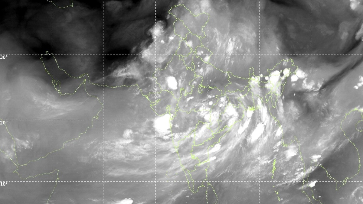
Somewhere around 3 am on July 22, while most of India slept, a satellite parked 36,000 km above the equator quietly took the country's photograph. India was not in it. Only cloud.That is not a figure of speech. Images from India Meteorological Department (IMD), taken by Isro satellites INSAT-3DR and INSAT-3DS between 2.15 am and 3.27 am, show a cloud sheet lying across nearly the entire subcontinent.WHAT DOES ISRO'S INSAT SATELLITE IMAGE OF INDIA SHOW?The thermal infrared frame is the plain one. Thermal infrared simply means the satellite is photographing heat rather than light, which is why the picture works perfectly well in the middle of the night.It shows a curved cloud band sweeping from the north Bay of Bengal across Odisha, Chhattisgarh and Madhya Pradesh, out towards Gujarat and the Arabian Sea. Western Rajasthan and Kutch are the main gaps. The INSAT-3DS thermal infrared frame from 3 am on July 22 traces a curved cloud band running from the north Bay of Bengal to Gujarat, leaving only western Rajasthan and Kutch clear. (Photo: IMD) The water vapour frame is the moisture channel. It shows a loaded atmosphere from the Arabian Sea to the Himalayas, which is what lets clouds keep forming for days rather than hours.WHY DO COLD CLOUD TOPS MEAN HEAVY RAIN?The third image is the one forecasters reach for first. It maps cloud top brightness temperature. Air cools as it rises, so the taller a cloud grows, the colder its top. Measure that temperature from space, and you have measured the cloud's height without leaving the ground. It is one of the oldest tricks in monsoon research. Red patches over Bihar, the northeast and the Himalayan foothills mark cloud tops colder than minus 60 degrees Celsius, placing those thunderstorms 12 to 16 km above the ground. (Photo: IMD) The red and pink blobs over Bihar, the northeast and the Himalayan foothills mark tops colder than minus 60 degrees Celsius, some below minus 80. That puts them roughly 12 to 16 km up, brushing the tropopause, the lid where the weather-making layer of the atmosphere ends.Only a fully grown cumulonimbus, the anvil-topped thunderstorm cloud, climbs that high. The rain gauges agree. In the 24 hours to July 20, IMD logged 37 cm at Williamnagar in Meghalaya and 22 cm at Shama in Uttarakhand.WHERE IS THE MONSOON TROUGH RIGHT NOW?The monsoon trough is the low-pressure belt lying across northern India in the rainy season, and it decides who gets rain. Drift it up to the Himalayan foothills and the plains dry out.The IMD's bulletin puts it near its normal position, with cyclonic circulations, which are simply columns of spinning air, over Punjab, southern Uttar Pradesh, the Jharkhand-Bihar belt, southwest Rajasthan and Assam.Crucially, a trough in the middle atmosphere runs from the west-central Bay of Bengal all the way to the northeast Arabian Sea. That is the diagonal streak of cloud slicing across your image.WILL THIS FIX INDIA'S RAINFALL DEFICIT?Not on its own. June 2026 gave India 99.5 mm, about 40 per cent below normal and the fifth-driest June since 1901. IMD's monthly outlook expected July to finish below 94 per cent of its long period average of 280.4 mm.The IMD expects active monsoon conditions over northwest and northeast India for four to five days, while west-central and south peninsular India stay subdued.A cloud sheet this wide is a very good night for the monsoon. It is not yet a good season.- EndsPublished By: Radifah KabirPublished On: Jul 22, 2026 09:22 IST
Monsoon clouds swallow 95% of India, Isro satellite images show: What to expect
Full Article
Original Source
Read the full article at Indiatoday →KhanList aggregates and links to publicly available news content. We do not host full articles from third-party sources. Always verify important information with original sources.