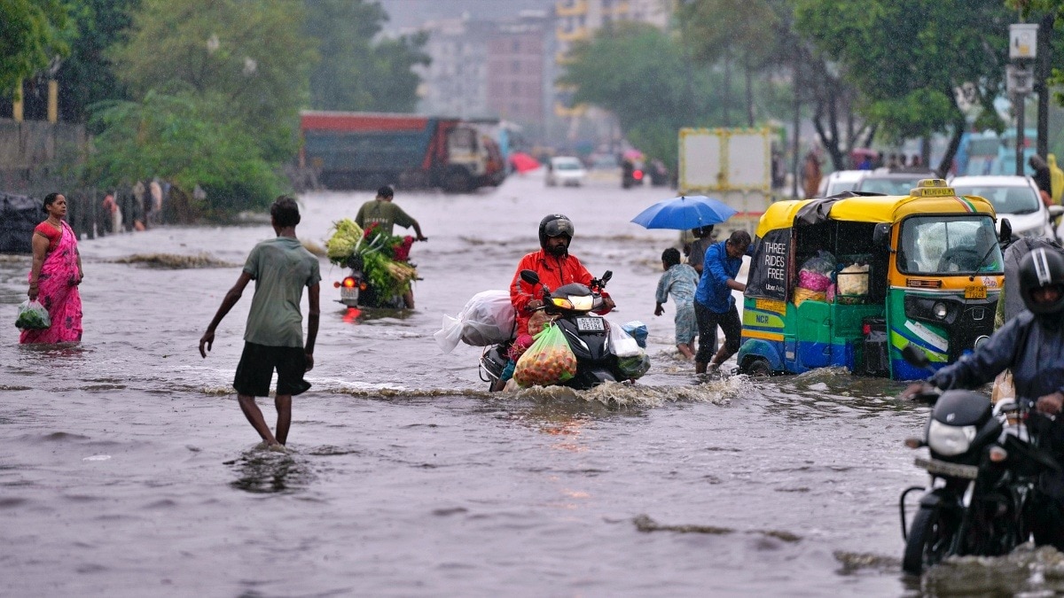
A deep depression that crossed the West Bengal-North Odisha coast is moving inland, driving heavy to very heavy rain across northern, central and eastern India on Tuesday.New Delhi: People make their way through a waterlogged road following heavy rain, in the Gazipur area of New Delhi., on Thursday morning, July 9, 2026. (PTI Photo)India is set for another day of widespread monsoon activity on Tuesday as a deep depression over the Bay of Bengal moves inland, bringing heavy to very heavy rainfall across large parts of northern, central and eastern India.The India Meteorological Department (IMD) has warned that the system, combined with an active monsoon trough, will keep weather conditions favourable for intense rainfall over several states.The deep depression, which crossed the West Bengal-North Odisha coast on Monday, is expected to continue moving north-northwestwards, carrying enormous amounts of moisture inland.The weather system is likely to trigger widespread rain across the Indo-Gangetic plains and central India through the day. For Delhi, Haryana, Punjab and Chandigarh, Tuesday marks the beginning of an active spell of monsoon rainfall. The IMD has forecast widespread showers with isolated heavy rainfall, raising the possibility of waterlogging in low-lying areas and traffic disruptions.Similar conditions are expected across West Uttar Pradesh, while East Uttar Pradesh is likely to witness heavy to very heavy rainfall at isolated places.In the hills, Himachal Pradesh and Uttarakhand will continue to receive widespread rain, with heavy to very heavy showers increasing the risk of flash floods and landslides, particularly in vulnerable mountain districts.The rain belt will remain active over Madhya Pradesh, Chhattisgarh and Vidarbha, where widespread rainfall is expected. East Madhya Pradesh and Chhattisgarh could receive heavy to very heavy rain, while West Madhya Pradesh is also likely to see heavy showers.In eastern India, the focus shifts to Odisha, Gangetic West Bengal and Jharkhand. Odisha is expected to continue receiving heavy rainfall even after the depression moves inland, while Gangetic West Bengal and Jharkhand could experience heavy showers as the system tracks northwestwards. Sub-Himalayan West Bengal and Sikkim are also likely to receive heavy rain.Along the west coast, monsoon activity will remain vigorous over Konkan and Goa, Madhya Maharashtra, Kerala, Coastal Karnataka and adjoining regions. Heavy rainfall is forecast in several places, particularly along the Western Ghats.The IMD has also warned of thunderstorms accompanied by lightning and gusty winds over parts of Odisha, Kerala, Karnataka, Telangana and the Andaman and Nicobar Islands.Strong winds are likely over coastal Karnataka, Kerala and Telangana, while fishermen have been advised to avoid venturing into affected sea areas due to rough conditions.With the deep depression continuing its inland journey, Tuesday is expected to be one of the wettest days of the week across much of India, bringing much-needed rain to several regions but also increasing the risk of localized flooding, landslides and urban inundation.- EndsPublished By: Sibu Kumar TripathiPublished On: Jul 27, 2026 19:30 IST
Bay of Bengal to send heavy rain across North, Central India on Tuesday
Full Article
Original Source
Read the full article at Indiatoday →KhanList aggregates and links to publicly available news content. We do not host full articles from third-party sources. Always verify important information with original sources.