
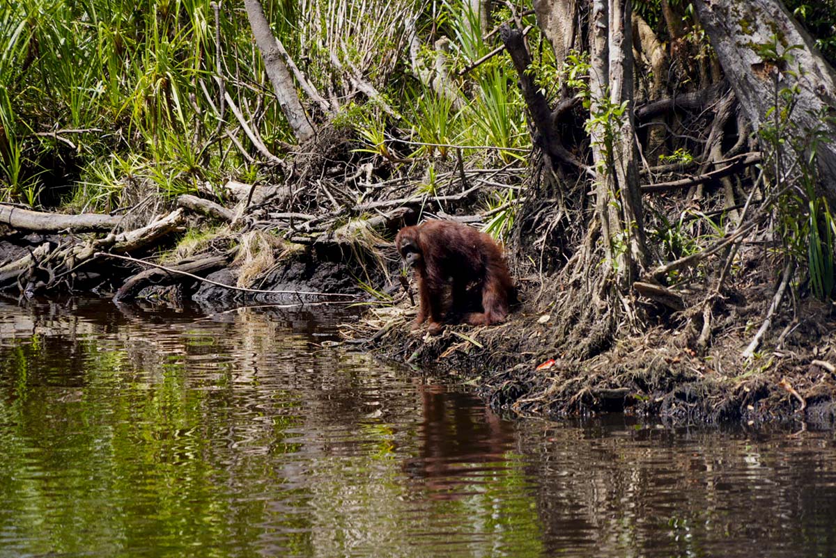
Fires are spreading across Bornean orangutan habitat in West Kalimantan, including Gunung Palung National Park and the Mendawak Biodiversity Corridor.Conservationists said losing forest in the national park would be devastating for its large orangutan population and long-running research program.More than 40 people, including field assistants, staff and local villagers, have been working around the clock to protect a research station from the fires.Geopix detected 17,865 fire hotspots in mapped orangutan habitat across Kalimantan between June 1 and Aug. 28, while conservationists warn that fires are shrinking the forest available for orangutans to escape. JAKARTA — As fires continue to engulf large swaths of forest in Indonesian Borneo, orangutans have increasingly fewer places to flee, with fires either surrounding them or eliminating the forest on which they depend. Fires are spreading across a connected but heavily fragmented forest landscape and the habitat of critically endangered Bornean orangutans (Pongo pygmaeus) in West Kalimantan, including Gunung Palung National Park and the Mendawak Biodiversity Corridor. Gunung Palung National Park is one of the most important remaining strongholds for the Central Bornean orangutan, supporting a population historically estimated at around 2,500 animals and hosting one of the world’s longest-running studies of wild orangutans. Its importance derives from both its population size and its unusually diverse forest habitats, which support long-term ecological research and a range of other species. The adjacent Mendawak Biodiversity Corridor has a complementary role. Although it is not yet a continuous or fully secured corridor, it encompasses additional orangutan habitat outside the national park and provides a framework for maintaining, restoring and reconnecting forest patches across a fragmented landscape. Despite their ecological importance, both areas have been burning during this year’s dry season, as an exceptionally strong El Niño has contributed to hot and dry conditions across Indonesia. A Bornean orangutan (Pongo pygmaeus). Photo by Rhett A. Butler National park on fire Spatial analysis by technology consultancy TheTreeMap shows that hotspots started appearing in Gunung Palung National Park on Aug. 27. TheTreeMap has also identified hotspots that appear to overlap with the park’s core zone, a strictly protected area reserved for biodiversity preservation, scientific research and the maintenance of natural habitat. Timelapse animation that shows fires spreading in the Gunung Palung National Park in West Kalimantan from early August 2026 to September 12, 2026. Hotspots started showing on August 27. Image courtesy of TheTreeMap/Nusantara Atlas. However, the Ministry of Forestry told Mongabay that whether fires are specifically within the core zone is still being verified against the precise fire locations and the park’s zoning map. The ministry, citing the Gunung Palung National Park Office, confirmed that fires are occurring at several locations within the national park, with an estimated affected area of approximately 9,055 hectares (22,000 acres) — half the size of Washington, D.C. in the U.S. Chris Wiggs, executive director of the NGO Sangga Bumi Lestari, said the fact that fires could enter a nationally protected area such as Gunung Palung was devastating given its importance for orangutans and biodiversity. “It got a big orangutan population and it’s been an active research site, so losing that forest is devastating for the orangutans as well as for the climate,” he told Mongabay. Wiggs was referring in part to the Cabang Panti research station in the park’s core zone and its satellite research station, Rangkong, which are part of one of the world’s longest-running studies of wild orangutans. According to The Guardian, fires recently came within approximately 200 meters (656 feet) of Rangkong, while Cabang Panti lies about four miles (6.4 kilometers) to the north. More than 2,500 orangutans are believed to inhabit the national park, according to The Guardian. “Orangutans are fleeing from these forests. It’s just horrible,” said Cheryl Knott, a biological anthropologist at Boston University in the U.S. who has been leading scientific research on orangutans at Cabang Panti for 32 years. Cabang Panti research station in Gunung Palung, Indonesia. Photo by Rhett Ayers Butler Research data at risk More than 40 people, including field assistants, staff and local villagers, have reportedly been working around the clock to protect the station. They have constructed a firebreak and an improvised sprinkler system using a punctured hose to saturate the surrounding peat. Researchers at the station have followed individual animals over decades and collected data on orangutan behavior, life histories, reproduction and forest ecology, resulting in a rare long-term database of individual wild orangutans. The long-term nature of the database is one of the site’s most important scientific assets. Researchers have tracked some orangutans from birth through adulthood, generating observations that cannot easily be replicated elsewhere. Gunung Palung National Park is also unusually valuable as a research site because of the range of forest ecosystems found there, according to Sulidra Frederik Kurniawan, animal and habitat protection manager at Yayasan Palung, an NGO that works on orangutan conservation in the area. “It is not like other places. With that variety of habitat, Gunung Palung National Park is one of the best [for orangutan research],” he told Mongabay. But the fires threaten to undo such continuous observations. At the rate the flames were moving at the time, without intervention or large firebreaks, the fires could reach Cabang Panti in about 20 days, according to scientists quoted by The Guardian. Sulidra said he was more concerned about the main research station, Cabang Panti, because it is farther from a water source than Rangkong, which has a river in front of it. “The satellite camp may still be protectable. It’s the areas farther from the water source that are the concern,” he told Mongabay. Beyond the potential loss of decades of research data, the fire also threatens the orangutans living in and around the research area. “Five orangutans from our long-term study population were observed fleeing the fire, some only meters from the flames,” said Wahyu Susanto, research director for Yayasan Palung. “These are individuals that we have followed and studied for years.” If fires continue to spread, orangutans could face an increasingly difficult search for food and safe forest, conservationists fear. “If the orangutans are unwell [when you find them], you need to treat their condition, but if they’re okay, ideally you release them straight away (translocation), but when all the forest is on fire, where do you release them?” Wiggs asked. Mendawak is a highly significant yet largely unprotected landscape overlapping Kubu Raya, Ketapang, Sanggau and Kayong Utara. It is home to critical orangutan habitat, tropical forests, deep peatlands, and the province’s largest mangrove system. Mendawak’s centrepiece is the 100,000-hectare Mendawak Biodiversity Corridor. The corridor runs north to south down Mendawak’s eastern portion. Spanning two oil palm concessions, four pulp and paper concessions, and nine village forests, it is governed by a Corridor Working Group and provides a rare example of multi-stakeholder forest management outside of protected areas. Image courtesy of Sangga Bumi Lestari. Mendawak The Mendawak Biodiversity Corridor covers nearly 100,000 hectares (247,000 acres) in eastern Mendawak and includes a mosaic of industrial concessions, village forests and other forest areas. The initiative, supported by Sangga Bumi Lestari, is designed to secure and reconnect habitat in a landscape that is already heavily fragmented. A population and habitat viability assessment (PHVA) estimates that the broader corridor supports between 798 and 1684 orangutans, although the areas surveyed are not clear. Sangga Bumi Lestari describes it as likely one of the largest orangutan populations outside protected areas. Because much of the landscape lies within industrial concessions and biodiversity data remain limited, the estimate should be understood as a landscape-level assessment rather than a recent census of every orangutan in the corridor. Unlike Gunung Palung, most of the Mendawak corridor lies outside the national park system and is managed through a mixture of industrial concessions, village forests and other land uses. At the western edge of the corridor is the 6,788-hectare (16,800-acre) Sungai Paduan Protected Forest, designated under Indonesia’s social forestry program as a village forest. Yayasan Palung supports conservation activities there, including annual orangutan nest surveys. The area has an estimated population of about 63 orangutans, according to the Mendawak Biodiversity Corridor project. Fires have nevertheless severely affected parts of the landscape. Hotspots in the Mendawak Biodiversity Corridor in September 2026. Image courtesy of Sangga Bumi Lestari. Sulidra said fires had burned 49% of the Sungai Paduan landscape as of Sept. 11, while fires were also moving northward through other parts of Mendawak. “There’s still some forest left in the north of the landscape, but fires are quickly moving farther north, splitting the landscape into two,” he said. In total, 17,106 hotspots had been detected in the Mendawak Biodiversity Corridor over the past 30 days, according to Sangga Bumi Lestari. As a result, forests where orangutans can escape are shrinking, said Mohammad Taufik Hidayat, the Mendawak Biodiversity Corridor project manager at Sangga Bumi Lestari. “Orangutans can no longer go anywhere. There are fires everywhere, and they are surrounded,” he told Mongabay. “Initially, the fire appeared in the south and moved north, and then there were fires moving from west to east. This is what is putting pressure on the orangutans, because the forest is beginning to disappear, and they are also under pressure from the smoke.” Smoke from forest fires can also affect orangutan health, according to Ronny Rachman Noor, an ecological genetics expert at IPB University. He said fine PM2.5 particles can penetrate deep into the respiratory system and reach the lungs, potentially causing inflammation and irritation. Ronny said short-term exposure can cause symptoms including coughing, shortness of breath and oxygen deficiency, while prolonged exposure could potentially contribute to respiratory diseases. He also said smoke exposure can affect metabolism and the immune system. These effects are particularly concerning for orangutans forced from forests into areas closer to human settlements, where they can also face increased risks of conflict, he said. The risks are not merely theoretical. On Aug. 30, an adult male Bornean orangutan named Sempurna died after being found severely weakened and suffering from respiratory distress in Ketapang district. According to the Ministry of Forestry, Sempurna was found in a dry ditch in a community oil-palm plantation. BKSDA West Kalimantan and Yayasan International Animal Rescue Indonesia provided oxygen and intravenous fluids before taking him to a rehabilitation center, but his condition deteriorated and he died later that day. A necropsy conducted on Sept. 1 found pathological changes in several organs, particularly the lungs, heart and kidneys. The ministry said the lung abnormalities were suspected to be associated with smoke exposure and could have impaired lung function, causing acute hypoxia. The condition was subsequently suspected to have contributed to cardiovascular dysfunction and Sempurna’s death. This male orangutan, named Sampurna, was found by residents in a weak condition near an oil palm plantation in Ketapang, West Kalimantan. Image courtesy of YIARI. Mayawana Persada Fires have also been spreading across concessions in the Mendawak Biodiversity Corridor. One of them is pulpwood producer PT Mayawana Persada, which contains the largest currently documented orangutan population estimate within the defined Mendawak Biodiversity Corridor. The size of the concession is 136,710 hectares (337,800 acres), according to Mayawana’s own public documents and the Ministry of Forestry. Since 2016, approximately 40,000 hectares (99,000 acres) of forest have been cleared, according to Sangga Bumi Lestari, with around half of that clearing occurring in 2023 alone. Much of the clearing has occurred on peatlands, which store large amounts of carbon accumulated over thousands of years. When peatlands are drained, the water table falls and the peat becomes more vulnerable to oxidation and fire. According to Mayawana’s own public summary, nearly half of its concession consists of peat soils. Sangga Bumi Lestari describes a remaining 35,624-hectare (88,000-acre) central forest strip running from south to northeast through the concession as the most important orangutan habitat within the corridor. Biodiversity surveys conducted by Sangga Bumi Lestari in 2025, including the deployment of 35 camera traps, confirmed orangutans in every section of the forest block. An orangutan nest survey conducted by the Faculty of Forestry at Tanjungpura University, with the data analyzed by Yayasan Palung experts, further confirmed their presence. Sangga Bumi Lestari estimates that the forest block supports 124 to 190 orangutans. The population estimate is significant because the same forest block represents only part of the much larger Mayawana concession and is one of several remaining habitat blocks in the wider Mendawak landscape. According to Sangga Bumi Lestari, land development in the concession was halted in March 2024 following a government order. Environmental groups have warned that forest clearing and drainage of peatland could increase fire risk by drying the ecosystem. Those concerns have taken on new urgency this year, when fires burned approximately 327 hectares (808 acres) of Mayawana’s concession, according to the Ministry of Forestry. On Sept. 3, the ministry announced an administrative sanction against Mayawana that included freezing its business permit and requiring environmental recovery measures. Satellite monitoring by NGO Auriga Nusantara identified hotspots in areas of peatland that the organization said had previously been cleared. Sentinel-2 imagery also showed smoke over cleared areas. Sentinel-2 satellite image of burning areas inside PT Mayawana Persada in August 2026. Image courtesy of Auriga Nusantara On Aug. 28, Auriga Nusantara forest director Supintri Yohar said the pattern visible in satellite imagery suggested that fire had moved across canal blocks and burned remaining vegetation. Yetno Budi Wibowo, campaign and advocacy manager at Lingkaran Advokasi dan Riset (Link-AR) Borneo, described the peatland fires in Mayawana as out of control, with strong winds spreading the flames rapidly. Hotspots were also detected in community plantations and village forests surrounding the concession. While some fires occurred outside the concession, Wiggs said people should not be quick to blame farmers because industrial development had also altered the landscape. “Sure, they shouldn’t really be using fire, but the reason the fires spread is because companies have degraded so much peat, and they created such dry conditions, so the fires can just spread easily,” he said. “And because peat is a naturally wet ecosystem, when you drain it, it becomes really dry, and fire spreads so quickly.” Nevertheless, Wiggs said companies in the Mendawak Biodiversity Corridor, including Mayawana, have taken action to fight fires and help surrounding villages. Mayawana, for instance, has established a firefighting team and invested in firefighting equipment, he said. “We have to remember that the reason the fire [is] spreading is them, but at the moment they’re working hard to put the fires out,” Wiggs said. Fire broke out on Aug. 11, 2026, near YIARI’s orangutan rehabilitation center in Ketapang district, West Kalimantan province. Image courtesy of YIARI. Rebuilding the corridor The fires burning across Gunung Palung National Park and the Mendawak Biodiversity Corridor are an alarm for all stakeholders, including the government and concession holders, to act not only to fight the ongoing fires but also to protect forests from future fires, according to Annisa Rahmawati, a senior wildlife campaigner at NGO Geopix. The scale of the crisis is evident from the increasing number of orangutans rescued from burning forests and the death of Sempurna, she said. As of Sept. 16, local authorities and YIARI had rescued 21 orangutans. Satellite monitoring by Geopix identified 17,865 hotspots within its mapped orangutan habitat in Kalimantan between June 1 and Aug. 28, 2026, representing 78.5% of the 22,744 hotspots it counted across Kalimantan during that period. With much orangutan habitat burned during this year’s fire season, restoring burned areas will be crucial to ensuring that orangutans have forest to return to, Rahmawati said. “Forests must exist in any orangutan conservation activities,” she told Mongabay. “Where can we release orangutans or tigers into [after rescuing them] if there’s no forest?” Without swift intervention, the fires could spread farther across the Mendawak Biodiversity Corridor and threaten efforts to maintain the landscape as a connected habitat, Wiggs warned. The corridor is also intended to demonstrate whether companies, communities, government agencies and conservation groups can cooperate to protect orangutan habitat across a fragmented, multi-use landscape. Companies with concessions inside the corridor and local government agencies have been working with NGOs including Sangga Bumi Lestari and Yayasan Palung through a corridor working group. The working group plans to conduct camera-trap and vegetation surveys to determine which areas need to be restored, Taufik said. “We will then strengthen and develop standard operating procedures and a system for preventing and controlling forest and land fires,” he said. Part of the system will involve village zoning, with stakeholders identifying areas inside villages that can be cultivated, which should be protected and which are water sources, Taufik said. Stakeholders also plan to map bore wells that were built in the past but whose locations are no longer known because they have become covered by shrubs, he added. The locations of the bore wells will then be incorporated into a dashboard. “In the zoning system, there will be protection zones for water sources and bore wells, and these are expected to serve as wetting resources. So one or two months before the fire season, there will be stages of mitigation for forest and land fires,” Taufik said. “That is why identifying water sources is important. The people are there, the equipment is there, but there is no water. This is what makes it difficult to extinguish fires in the field.” Sangga Bumi Lestari said it’s still too early to start planning recovery, given that conditions remain extremely dry and there’s a strong likelihood that some areas will burn again. Nevertheless, the NGO has begun surveying areas where fires had already been extinguished to understand the damage and help it better prepare all stakeholders for future fire events. “As El Niño conditions look set to continue into 2027, we’re using this reprieve to document water sources, identify potential boreholes areas, and support canal blocking,” Wiggs said. “Degraded peat burns underground and fires can ignite at any moment. Making sure these areas are as wet as possible is the best defence we have.” Banner image: An adult orangutan drinking from a peat river in the Tanjung Puting National Park area, Central Kalimantan. Image by Rendy Tisna/ Mongabay Indonesia. FEEDBACK: Use this form to send a message to the author of this post. If you want to post a public comment, you can do that at the bottom of the page. Credits Topics
As fires spread in Indonesia, Bornean orangutans run out of forest to flee
Full Article
Original Source
Read the full article at News →KhanList aggregates and links to publicly available news content. We do not host full articles from third-party sources. Always verify important information with original sources.