
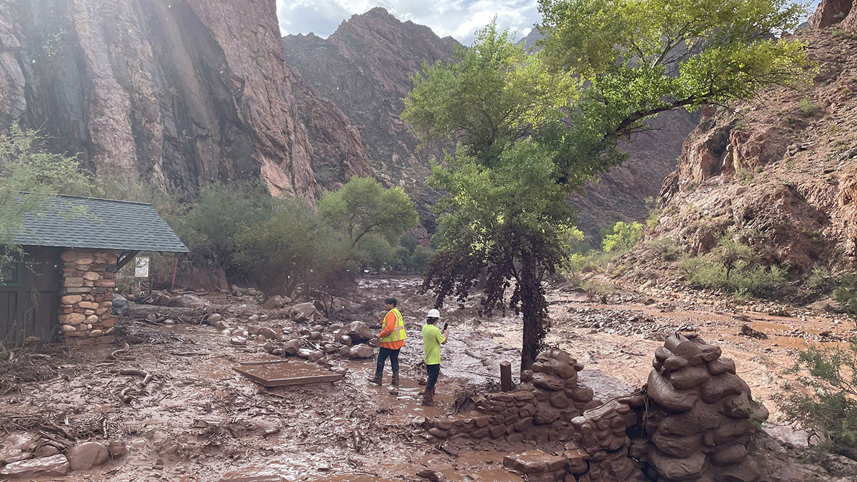
Two people stand near a footbridge that was destroyed in the Bright Angel flash flood, less than two hours after the flash flood began on the afternoon of 29 August. Monsoon rains, following drought conditions and a 2025 fire in the area, combined to lead to dangerous flash flooding in the Grand Canyon. Credit: Grand Canyon National Park Service, CC BY 4.0 Research & Developments is a blog for brief updates that provide context for the flurry of news that impacts science and scientists today. Last weekend, flash flooding in the Grand Canyon killed two, left one missing, and forced dozens to evacuate. On Monday, the National Park Service shared that approximately 40% of the Transcanyon Waterline—the national park’s only water pipeline—had been damaged or destroyed. Considering the ongoing discourse about the struggle to allocate the limited water supply of the Colorado River, the onslaught of water may have seemed not just tragic, but confusing. However, flooding isn’t all that uncommon in the Grand Canyon. “Flash floods are not a new thing for this canyon or for anywhere in the Grand Canyon region,” Laura Crossey, a hydrologist at the University of New Mexico, told Scientific American. What stood out about these monsoon rains is where they fell. Last summer, the Dragon Bravo Fire burned nearly 150,000 acres and damaged or destroyed more than 100 structures along the canyon’s north rim. The Grand Canyon was also experiencing severe drought conditions in August, according to the Center for Western Weather and Water Extremes (CW3E). In combination, the burn scar and the drought led to soil more susceptible to debris flows. So, when Tropical Storm Karina (itself fueled by record-breaking El Niño conditions) began fueling monsoonal rains over the eastern Grand Canyon last week, conditions were primed for flooding. One U. S. Geological Service precipitation gauge, at Bright Angel Creek below Ribbon Falls, recorded 1.16 inches of precipitation in about 45 minutes before being damaged by flood waters. Such rainfall levels had just a 2% to 4% likelihood of occurring, according to the CW3E. Another gauge, along Phantom Creek, reported an approximately 6.5-foot rise in water height over a 45-minute period. Credit: Center for Western Weather and Water Extremes In August 2025, after the Dragon Bravo Fire, the Department of Interior’s Burned Area Emergency Response team took to the field “to assess post-fire threats to life, property, and critical natural and cultural resources.” Though the team found that natural recovery from the fire looked likely in most areas, they also noted that the fire could lead to stabilization issues along trails, hazardous rockfalls, and potential flood events. “This tragedy also underscores the broader reality facing parks across the Southwest. Extreme weather, wildfire and post-fire flooding are straining landscapes, communities and aging infrastructure,” said Alex Jones, Southwest Regional Director of the National Parks Conservation Association, in a statement. “To cope, parks need dependable funding, modern emergency systems and climate-resilient infrastructure.” —Emily Gardner (@emfurd.bsky.social), Deputy Editor These updates are made possible through information from the scientific community. Do you have a story about science or scientists? Send us a tip at [email protected]. Text © 2026. AGU. CC BY-NC-ND 3.0Except where otherwise noted, images are subject to copyright. Any reuse without express permission from the copyright owner is prohibited.
Why Did the Grand Canyon Flood?
Full Article
Original Source
Read the full article at Eos →KhanList aggregates and links to publicly available news content. We do not host full articles from third-party sources. Always verify important information with original sources.