
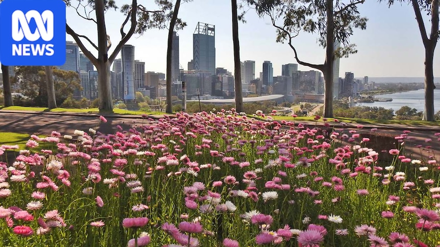
Western Australia's first month of spring was anything but straightforward.The state experienced a mixed bag of weather, from unusually heavy rain inland to sudden bursts of summer-like heat.Photos from our viewers from the month of September perfectly illustrate just how different WA's climate can be from one end of the state to the other.Grey clouds and a rainbow over a field in the Wheatbelt. (Supplied: Karen Siegert)The month began against the backdrop of a notably dry winter for a large part of the state.The first major downpour didn't deliver the rain to Perth or the South West, but hundreds of kilometres inland.A slow-moving trough drew tropical moisture into the Goldfields and the Interior, producing widespread cloud, rain and thunderstorms across the area.It brought well above average rainfall for many locations that often only see about 5 to 15 millimetres of rain in September.Yellow blooms in a field in Toodyay. (Supplied: Greg Brown)Leonora picked up 59mm in the 24 hours to 9am on September 7, its wettest September day on record and nearly double its old record of 32.6mm from 1984.The heavy rainfall led to flooded roads around Leonora and the closure of the Goldfields Highway and the Leonora-Laverton Road.Despite the rainy conditions in the interior, it was drier at Perth's City Beach. (Supplied: Robert Rouse)By the end of the month, the town had accumulated more than 136mm, a significant increase from its monthly average of just 9mms and smashing the station's old record of 83.3mm for the month back in 1904.Temperatures soarMid-way through the month, there was a large temperature contrast across the country.While south-eastern states shivered through below average temperatures, western parts of WA were sweating through more summer-like conditions as day-time temperatures soared up to 12 degrees Celsius more than usual.A dog walks on a beach in Mandurah beneath glowering grey skies. (Supplied: Regine Andersen)That heat was also thanks to that same trough system that had been driving storm activity through the interior.A strong high pressure system to the south helped push the trough back towards the south-west coast, where it dragged warm air down from the north, which had observed 40C temperatures during the month.The northerly winds saw temperatures soar across the southern half, with many locations challenging September records.Beachgoers enjoy the sunshine at Cottesloe in Perth. (Supplied: Clive Addison)Perth rapidly climbed to 30.3C on September 16, its first "30" of the season and its warmest day since April.It saw residents flood to Perth's beaches for a chance to soak up the summer-like conditions.Locals at South Perth foreshore, young and old, are enjoying the warmer weather. (Supplied: Greg Brown)The heat didn't ease after sunset, with the temperature only dropping to 18.2C early the next morning, just shy of its warmest September minimum ever.It wasn't just Perth that sweated through some warm nightsA pair of black swans, and cygnets, swim on the Swan River in Perth. (Supplied: Stuart Davis)Nearly a dozen spots observed their hottest minimums for September, including Wongan Hills which only got down to 21C.Murchison smashed its record from 1990 after dropping to a warm 19.8C and Cunderdin, Beverley and Badgingarra all broke their 15-year records.Blue skies and warm daytime temperatures were seen in many parts of the state. (Supplied: Rod Lawson Kerr)And the records kept tumbling during the day.Katanning reached a toasty 31.8C on September 17, just tipping over its previous record from 2006.Albany was one of the locations which experienced temperatures higher than usual. (Supplied: John Rich)Rocky Gully South, North Walpole and Albany Airport also set new September records after reaching well above average temperatures for the month.More unseasonal rainThe unusual rainfall events continued in the state's interior.By late September, another moisture-rich system was generating heavy rain and thunderstorms across parts of the Goldfields, Interior and south-eastern parts.Rawlinna Station, located between Kalgoorlie and Eucla, experienced late-September thunderstorms. (Supplied: Stu Parker)Kalgoorlie-Boulder recorded about six times its average September rainfall, picking up just over 80mm.The storm activity was another unseasonal event for a part of the state that is often dry during Spring.Some viewers took to the road to experience the springtime conditions. (Supplied: Peter Randell)That trough system was pushed back towards the south-west coast where it developed into a low pressure system, delivering rain across the weekend to central and southern parts of the state.After a run of warm sunny days, Perth decided to foreshadow the gloomy ending of the AFL Grand Final by recording its coolest day of the month at a top of 17C.A visitor enjoys the view from a platform at Bibra Lake. (Supplied: Gloria Daniels)While the city missed out on much of the rainfall over the month, it received one final good dumping on the last day, pushing its total to just over 38mm, less than half its monthly average for September.The Bureau of Meteorology has forecast an increased chance of unusually high rainfall across much of southern and central WA over October, which could make up for that lack of rain.
WA's varied climate — rainfall to heat — captured in the first month of Spring
Full Article
Original Source
Read the full article at Abc →KhanList aggregates and links to publicly available news content. We do not host full articles from third-party sources. Always verify important information with original sources.