
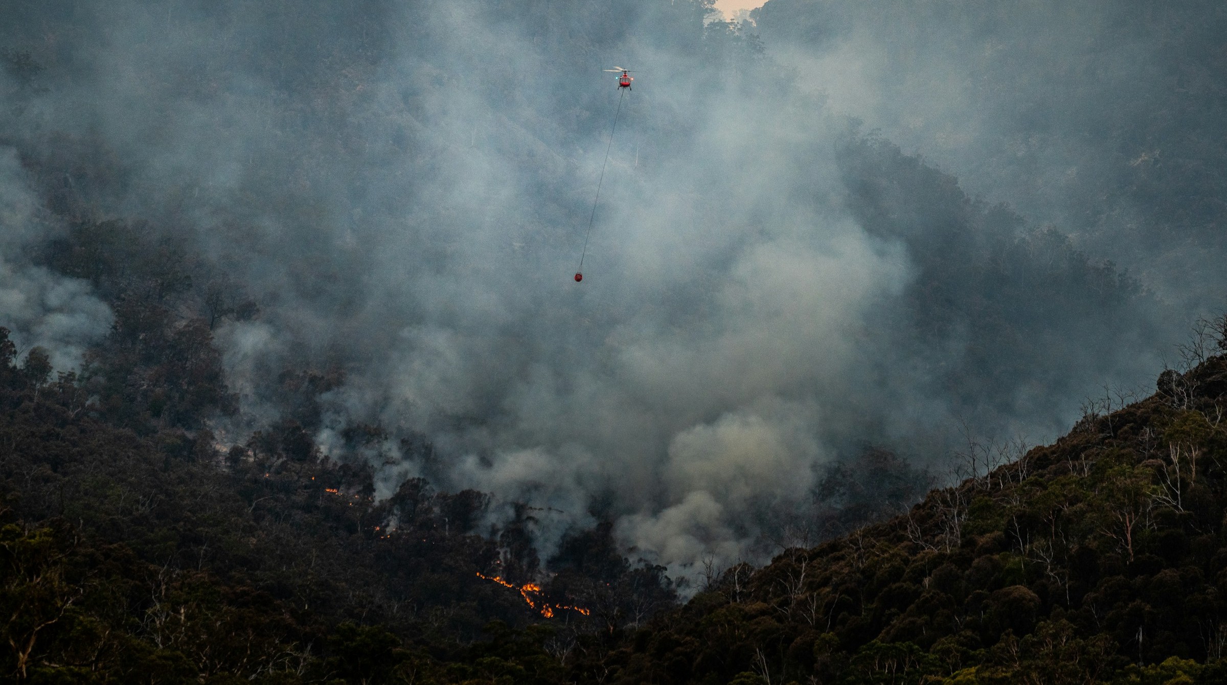
An $11 million competition to identify technologies to detect and respond to wildfires has culminated after final rounds of testing in Australia and Alaska.The XPRIZE Wildfire competition focused on two aspects: satellite-based detection, and autonomous response to wildfires.While no team claimed the grand prize in either category, XPRIZE Wildfire’s Andrea Santy said the technologies on display showed tremendous promise and progress over the four years of the competition.The XPRIZE Foundation, which organized the competition, will now work with the participating teams to scale up the solutions for real-world deployment. How do you detect and mitigate destructive wildfires? That question was at the heart of an $11 million competition that culminated recently after four years. In 2023, the nonprofit XPRIZE Foundation launched the XPRIZE Wildfire competition to identify innovative technologies that could detect and respond to wildfires. The competition focused on two tracks: satellite-based detection of small fires across large landscapes, and autonomous detection, navigation, and suppression of wildfires without human intervention. “We have been seeing more destructive fires,” Andrea Santy, executive director of the foundation’s wildfire program, told Mongabay in a video interview. “The fire season isn’t any longer just a season. It was becoming year-round.” The competition’s final round of testing took place earlier this year. The space-based wildfire detection aspect of the competition required participants to detect fires across a large landscape in Australia within 10 minutes. The autonomous response part, meanwhile, tested the ability of teams to detect and suppress a fire in rural Alaska within 10 minutes of it starting. While no one team claimed the grand prize in either of the tracks, Santy said the whole journey left her with a “huge amount of confidence that the technology over the past several years has been developing.” The competition now enters a phase where XPRIZE will work with the teams to translate the technologies into scalable solutions that can be deployed for real-world applications. While no teams claimed the grand prize, Andrea Santy, pictured above, said she has developed confidence that the technology has massively improved in the past several years. Image courtesy of Associated Press. Andrea Santy spoke with Mongabay’s Abhishyant Kidangoor about the technologies on display, the challenges that popped up during testing, and how XPRIZE plans to take the work forward. The following interview has been lightly edited for length and clarity. Mongabay: How would you describe XPRIZE Wildfire to someone who hasn’t heard about it before? Andrea Santy: Our elevator pitch is that XPRIZE Wildfire is a four-year, $11 million competition to spur innovation for wildfire technology. We doubled down on end-to-end detection, navigation, and response to wildfires. Mongabay: What was the motivation for looking at this particular problem? What gaps were you looking to fill? Andrea Santy: XPRIZE is a Los Angeles-based organization, and so this is a problem that’s very near to a lot of our staff and our leadership. Since 2015, we have been seeing more destructive fires in California, but also globally. The fire season isn’t any longer just a season. It’s becoming year-round, and there was an increase in the destructiveness of fires. This was something that was both a global need, but also just a very direct personal experience that a lot of people were feeling and realizing. We started fundraising in about 2018 and 2019. It took a couple of years, especially with COVID, to be able to raise the full amount. The goal really was to look at and say, “How do we solve this problem?” It was really through listening to experts and communities that we were able to double down on this question. And during the process, early detection and autonomous response became two key pieces that were continuously coming up as potential game changers. The XPRIZE Wildfire competition aimed to identify technologies to detect and respond to wildfires. Image courtesy of XPRIZE Foundation. Mongabay: Why did you choose those two tracks, and how did they complement each other through the competition? Andrea Santy: There’s space-based detection where the goal is to be able to detect fires across really big areas when the fires are very small. That one really is about detection and intelligence. How do you provide more information in near real time to firefighters about ignitions as well as what’s happening with the fires as they progress? That one was motivated a lot through the Minderoo Foundation and the Gordon and Betty Moore Foundation. They were looking at this problem more holistically and saying, “How are we going to be able to really improve this?” Think about Australia, the Amazon, and vast areas of Canada and Alaska. These are areas where we have fewer people but where a lot of wildfires start. So it is important to be able to ensure that we have good intelligence and awareness of what’s happening so that firefighters can ultimately decide: Are these fires that we want to address? All of that information is also going to lead to a next generation of better intelligence. As we have better satellite constellations, we’ll have more information. And therefore, our predictive modeling is going to be even better. The autonomous wildfire response is really looking at how you address a fire those first few moments after it starts. We did our testing in a really remote location because that’s what you needed to do for testing. But the idea is that these really would be solutions that could work anywhere, including in a wildland-urban interface. So you have to detect a fire, navigate to the fire, and then suppress it fully autonomously. This is before anybody knows that fire’s there, before the firefighters are on the scene, or before someone has called 911. It’s basically the smoke alarm for areas where you’re going to have the highest risk of destructive wildfires. Firefighters do a great job of responding; 85-90% of all wildfires are responded to and put out. It’s this really small percentage of fires that are not able to be addressed in those first instances, and so you have to have these really quick systems. It’s really exciting to know that these systems are pretty much there and ready. Santy and her team at XPRIZE Foundation will now work with the participating teams to scale up the solutions. Image courtesy of XPRIZE Foundation. Mongabay: What were some of the innovative solutions on display in both tracks? Andrea Santy: The testing was an opportunity to really see how the technology can be deployed in a real-life situation. And that’s what we undertook for both of these tracks. We had multiple rounds, but for finals, which is the pinnacle of the testing, we spent three weeks in Australia at the Rural Fire Service headquarters in New South Wales. The Rural Fire Service has prescribed-burn plans that are already scheduled, and so they were doing their prescribed burns for their fall season. In addition, there were a number of wildfire bushfires that were starting. So over the course of the competition, there were hundreds of fires that were potentially able to be detected. It was 10 full days of testing. These were all teams that did not use their own satellites. They used existing satellite constellations that are up there. Satellite constellations have different patterns. Some orbit with the Earth. Some are orbiting in opposite ways, so they’re getting a capture of the same area more quickly. So there’s the geostationary and then the LEO [low Earth orbit] satellites. They were using really everything available to them — all the public assets, some private satellite constellations. The really interesting part was being able to take all of this data, fuse it together, and be able to deliver the information in a way that was really usable for firefighters. Geostationary gives you a larger swath that you can see, but the resolution isn’t very good. So that’s where you have these other satellites that are coming and passing by. The teams were taking that additional data and ingesting it in, and were able to have really good information to improve their prediction reliability and say, “We know that there is a fire, and now we’re able to give you higher confidence that this is a fire. It’s not a false positive.” The place where there still is a lot of challenge across the board is this question of false positives. So to really be able to drill down on that as more satellites go up with more sensors that are for wildfire is crucial. Our legacy satellites are really not built to detect wildfires. We use them for that, but that wasn’t why they were put up in the first place. As we get more and more satellites that have special sensors and abilities to be able to detect wildfire, we will have better information. That was a really great opportunity to be able to test out the technology over such a large area with so many different teams. We had eight teams that were testing, and so you could see where there were similarities and where there were shared challenges, and I think that those are some of the really important learnings. On the autonomous wildfire response side, we had three teams that tested. They were in a remote part of Alaska, between Fairbanks and Denali. We had them at an airport hangar about 18 miles [29 kilometers] away from our testing site. The testing site was a small area where they could deploy, and then 1000 square kilometers [about 390 square miles] which was our testing area. It was only accessible by one dirt road. They had a really confined deployment area, and so the teams were challenged with being able to detect a fire, respond to it, and suppress it. Our goal was to do it in 10 minutes, although we gave a longer window during testing. All three teams were able to detect the fire in essentially 11.5 minutes or below. We had two of our teams that were able to accurately do the full end-to-end. They navigated, got to the fire, and then accurately dropped suppression on the fire. It is a huge gain to be able to have this in a forested area where they were 18 miles away. They weren’t able to fully suppress the fire, which is why we didn’t award the full grant prize on either of our tracks. But there were still huge, significant gains to be able to see this end-to-end, especially fully autonomously. No one had eyes on the technology. A large plume of smoke billowing out of a mountain in California, 2024. Image by Tim Mossholder via Unsplash. Mongabay: What were the challenges, both from a technology point of view and in putting all of this together? Andrea Santy: My mantra for our autonomous wildfire response was that I didn’t want anybody to die. We were testing in the middle of the Alaskan wilderness. There’s a lot of wildfire there, and teams had two weeks to be able to get their technology out there. So we really wanted to make sure everything was done with safety as our first and foremost priority. The Alaskan wilderness is not an easy undertaking, especially for a lot of teams who had not spent time in the Alaskan wilderness before. So I would say that just conducting testing, for me personally, was probably one of the biggest stressors for the teams. For the teams, to be able to really decide their strategy and modify meant logistical hiccups and all sorts of different things that kept everybody on their toes. We had a wildfire start about 20 miles [32 km] away from a lightning strike. The town next door had to be evacuated during testing. So it really brought home the real-world need for being able to have the technology. Mongabay: Having gone through this whole journey, what surprised you the most? Andrea Santy: I was really excited that for our autonomous wildfire response, all three teams were able to detect fires essentially within minutes. We had set a 10-minute goal, and everyone was either right near it or under, and I think that that just provided a huge amount of confidence that the technology over the past several years has been developing. When we launched this competition in 2023, there were a few technologies out there that had cameras, but they weren’t doing autonomous detection yet. There were people doing drones, but again, not autonomous. Not beyond visual line of sight. And so, to be able to see the progress in such a short amount of time really was just absolutely phenomenal. I think that a lot of that has got to do with the full community coming together and saying that this is a problem that we can address, and looking at the different ways that this technology can help our fire service to be able to meet their end goal. It is really hard. There are fires that often start [several] at one time. It’s also increasingly happening in places where resources are not as abundant. If we can use technology to be able to provide ourselves with as much information as possible, we can target the fires we need to target. We can make sure that we’re pre-deploying. We can think about and have better information on where we would want to have secure fire lines, and be able to build more resilient communities. There’s no one silver bullet. None of these solutions are the only thing that are going to get us to where we need to be. It’s everything working together and being able to function in a way that the fire agencies and end users are going to be able to use that information. Firefighters battle a hotspot of the Fairview Fire, California, September 2022. Image by Cal Fire/Riverside County Fire Department via Wikimedia Commons (Public domain). Mongabay: You are now going into an impact phase. What will that look like? Andrea Santy: The impact phase is just starting to kick off. What I’m most excited about is being able to see the tech in action. A lot of our teams already have their systems up and running. So being able to see how the technology is going to work in service to our communities, to our fire agencies, is very exciting. These teams are brilliant. They’re passionate, and they really want to be part of the solution. They’ve already proven that and have dedicated a lot of time and effort. We’re going to try to cast a relatively large net with our impact phase to be able to understand and hear from end users, from communities, all the way up to utilities and fire agencies, to really understand where the technology is working. You don’t have to, all of a sudden, have a drone that’s detecting, navigating, and suppressing fires. We hope that we’ll be able to test that out, but I think, looking at these different components, we’ve got really interesting software teams that are layering their software on our existing fire or camera systems to be able to improve those and utilize them for wildfire detection. So I think there’s going to be a lot of different places where we see innovation happening. I live in coastal North Carolina, and we have wildfires here quite frequently. And so, just personally being able to know that the fire agencies have more assets at their disposal is exciting to me. While there’ll be more fires, because that’s the trend we’re seeing, we hope to be able to support the agencies with these tools and be able to see a reduction in the number of destructive wildfires. Banner image: Firefighting at Fingal, Tasmania, in 2020. Image by Conservation Commons via Unsplash. Abhishyant Kidangoor is a staff writer at Mongabay. Find him on 𝕏 @AbhishyantPK. ‘We have incredible & applicable solutions’: Interview with Peter Houlihan of XPRIZE Studies still uncovering true extent of 2019-20 Australia wildfire catastrophe Credits Topics
Testing the next generation of wildfire tech: Interview with XPRIZE Foundation’s Andrea Santy
Full Article
Original Source
Read the full article at News →KhanList aggregates and links to publicly available news content. We do not host full articles from third-party sources. Always verify important information with original sources.