
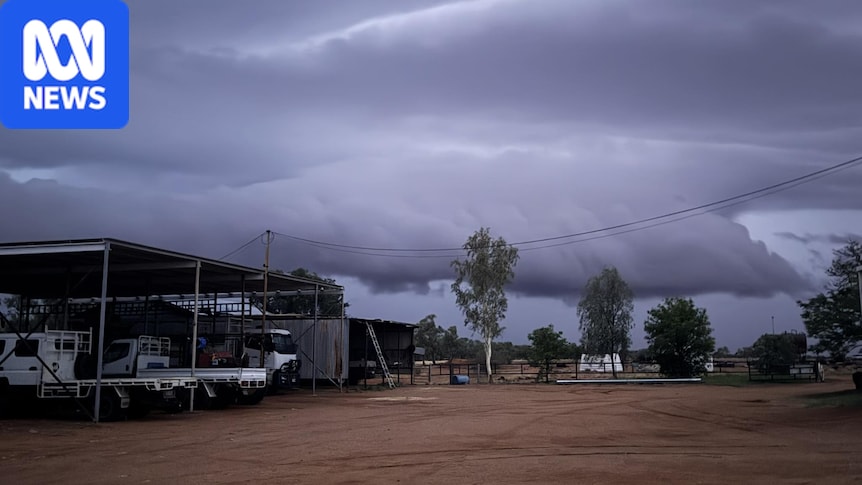
By Josh DyeABC Sunshine CoastPosted Mon 23 Nov 2026 at 7:32amMon 23 Nov 2026 at 7:32amStorms are predicted for south-western Queensland today and tomorrow. (Supplied: Rick Britton)In short: Severe storms could hit south-western Queensland early this week. The severe heatwave in Cape York Peninsula is finally set to ease. The state's south-east will be fine until Wednesday, when more thunderstorms could return. Severe thunderstorms are forecast to hit south-western Queensland, as a severe heatwave lingers in the state's far north. The Bureau of Meteorology predicts a fine start to the week in south-east Queensland before wet weather and storm activity returns later in the week. Senior meteorologist Harry Clark said the state's remote west was the biggest watch point on Monday and Tuesday. "Far western Queensland into the southern interior will be the storm focus," he said. "There's some severe storms possible west of around Charleville."The record-breaking heatwave in the Cape York Peninsula continues to cause above-average temperatures, but will begin to ease this week. The weather bureau's "severe" heatwave warning predicts maximum temperatures in the mid to high 30s and overnight temperatures in the mid-20s for Weipa and Aurukun.Storms are on the horizon for south-east Queensland. (ABC News: Charmayne Allison)Storms on horizon for SEQMr Clark explained why the south-east is enjoying "pretty average" temperatures and sunny days for now. "We're under a ridge of high pressure, so pretty settled conditions for what is the peak of our storm season," he said. "But once we get into the second half of this week, so Wednesday onwards, that's when we see the chance of a thunderstorm returning to Brisbane and the broader south-east and central Queensland area."At this stage, the severity looks fairly limited, so [we're] not expecting severe thunderstorms."Southern and central parts of the state could see a wet end to the week. (ABC News: Charmayne Allison)Rainfall totals for Brisbane, the Sunshine Coast and Gold Coast could reach up to 20 millimetres by the weekend. "It does look like it could be potentially quite a wet end to the week for southern and central Queensland," Mr Clark said."There's still a lot of uncertainty in that forecast; the weather patterns or weather systems that are driving it [are] shifting all over the place." Brisbane is forecast to be partly cloudy with a top of 29C on Monday, while the Gold Coast should reach 28C and Sunshine Coast is predicted to be 27C. There was a 2.8-magnitude earthquake off the coast of Bowen on Sunday afternoon, but no damage was reported.
Storms to hit south-western Qld as heatwave lingers in far north
Full Article
Original Source
Read the full article at Abc →KhanList aggregates and links to publicly available news content. We do not host full articles from third-party sources. Always verify important information with original sources.