
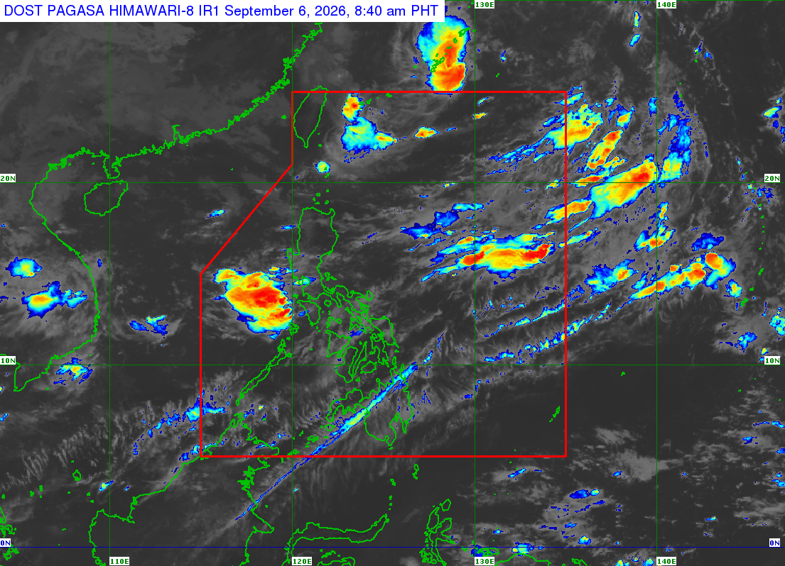
Satellite image captured on Sunday, September 6, 2026 at 8:40 a.m. (Pagasa) MANILA, Philippines — Tropical storm Pilandok (international name: Krovanh) may reenter the Philippine area of responsibility (PAR) on Sunday, according to the state weather bureau. In the 5 a.m. weather forecast of the Philippine Atmospheric, Geophysical and Astronomical Services Administration (Pagasa), weather specialist Obet Badrina said that as of 3 a.m., Sunday, Pilandok was tracked some 875 kilometers northeast of extreme Northern Luzon. “Halos nasa boundary ng PAR at hindi inaalis ang posibilidad na muli itong pumasok within the day. Kung papasok man ito, posibleng lumabas din within the day, lalabas din ng Philippine area of responsibility,” Badrina said. Article continues after this advertisement (It is almost within the PAR’s boundary and its possibility of reentering the PAR within the day is not ruled out. Once it does, it may also exit the PAR within the day.) READ: Light rains forecast on Sunday (Sept. 6); downpour may resume Monday He also said that once it reenters the PAR, it will move northward and will weaken into a tropical depression by Monday. “Pumasok man o hindi, inaasahan na magpapalakas ito ng southwest monsoon bagamat hindi magkakaroon ng direktang epekto sa bansa,” Badrina added. (Whether or not it re-enters the PAR, it is expected to enhance the southwest monsoon, however, it will not directly affect the country.) Article continues after this advertisement Rainy Sunday Meanwhile, Badrina said that the southwest monsoon will continue to bring rains over the western section of Luzon and Visayas. Article continues after this advertisement He noted that heavy rainfall is expected over Zambales, Bataan, parts of Cavite, Batangas, Occidental Mindoro. READ: Rainfall helps reduce air pollution from Indonesia wildfire – Pagasa He added that Metro Manila, and the rest of Luzon, including the Ilocos region, Cordillera Administrative Region, rest of Central Luzon, Mimaropa (Mindoro, Marinduque, Romblon, and Palawan), and Calabarzon (Cavite, Laguna, Batangas, Rizal, and Quezon) may experience cloudy skies with chances of light to moderate rainshowers. Fair weather forecast Western Visayas is forecast to have cloudy skies while fair weather is expected in the rest of the Visayas and Mindanao. Forecast temperature range in key cities / areas on Sunday Your subscription could not be saved. Please try again. Your subscription has been successful. Metro Manila: 25°C to 29°C Laoag: 25°C to 31°C Baguio: 16°C to 20°C Tagaytay: 23°C to 28°C Tuguegarao: 25°C to 34°C Legazpi: 26°C to 32°C Kalayaan Islands: 26°C to 32°C Puerto Princesa: 25°C to 32°C Iloilo: 26°C to 33°C Cebu: 27°C to 34°C Tacloban: 27°C to 34°C Cagayan de Oro: 25°C to 34°C Davao: 26°C to 33°C Zamboanga: 24°C to 34°C /gsg
Storm may reenter PAR Sunday; rain expected in parts of Luzon, Visayas
Full Article
Original Source
Read the full article at Newsinfo →KhanList aggregates and links to publicly available news content. We do not host full articles from third-party sources. Always verify important information with original sources.