
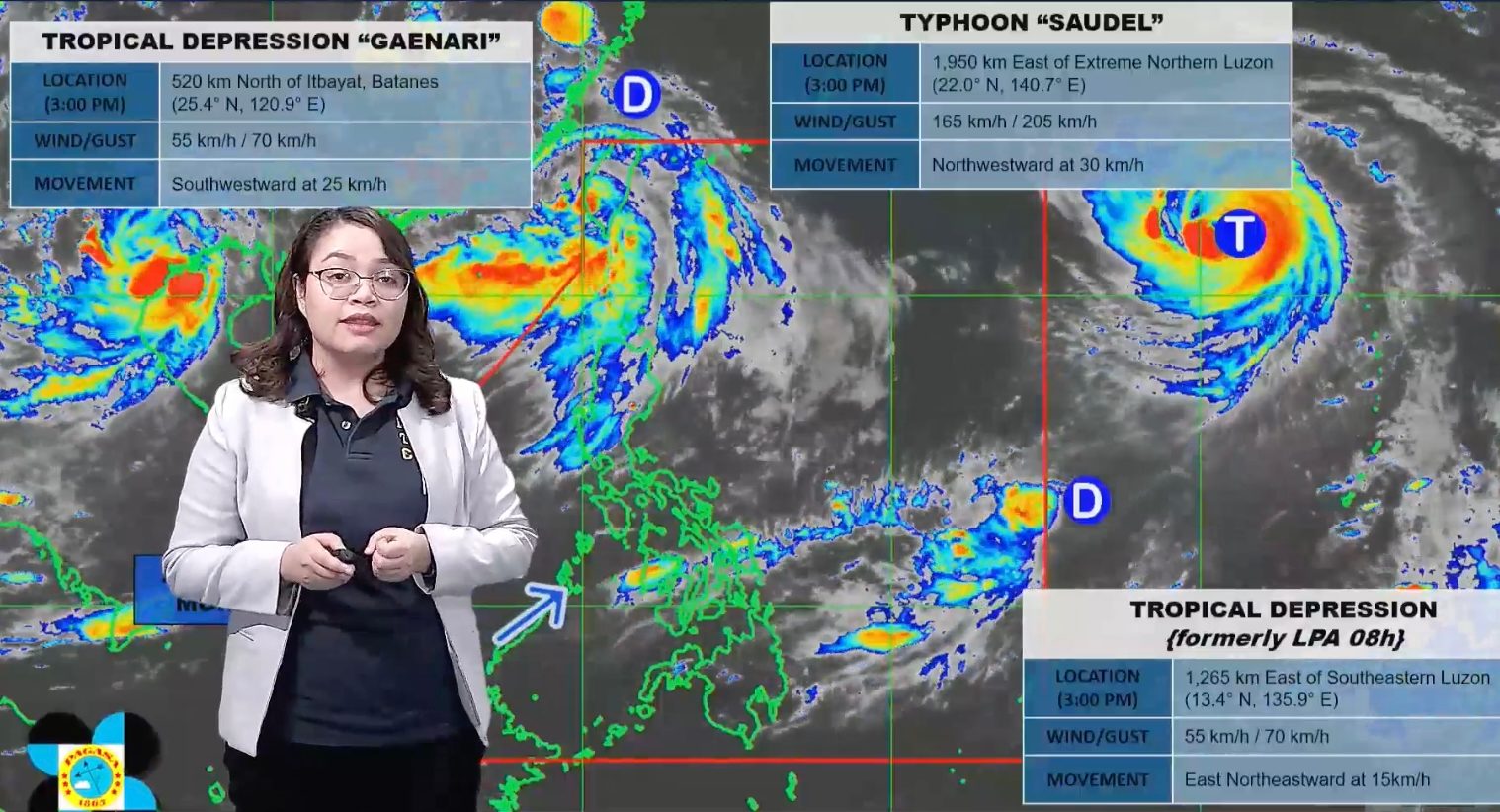
FORECAST. PAGASA Weather Specialist Charmagne Varilla explains the bureau's 4 pm forecast for the three tropical cyclones outside the Philippine Area of Responsibility on August 23, 2026. PAGASA Typhoon Saudel is located 1,950 kilometers east of extreme Northern Luzon at 3 pm on Sunday, August 23, still outside the Philippine Area of Responsibility Saudel could enter the Philippine Area of Responsibility as a super typhoon on Monday, August 24. Saudel is likely to enhance the southwest monsoon. A tropical depression, also located outside PAR, may enter before Saudel. This is AI-generated. Read the article for full context. Report any errors. MANILA, Philippines – The tropical cyclone with the international name Saudel could enter the Philippine Area of Responsibility (PAR) as a super typhoon on Monday, August 24. As of Sunday afternoon, August 23, Saudel remains a typhoon outside PAR. It was located 1,950 kilometers east of extreme Northern Luzon at 3 pm, moving northwest at a relatively fast 30 kilometers per hour (km/h). So far, Saudel has maximum sustained winds of 165 km/h and gustiness of up to 205 km/h. But it could strengthen into a super typhoon before its possible entry into the northeastern corner of PAR, which may happen either Monday morning or afternoon. Saudel is likely to remain far from Philippine landmass, and may already exit PAR on Tuesday, August 25. But PAGASA added that the tropical cyclone might stay inside PAR beyond Tuesday — just along the northern boundary — if its track shifts westward. It could also be downgraded back to a typhoon around this time. Although Saudel is not expected to directly affect weather and sea conditions in the country, it is seen to eventually enhance the southwest monsoon or habagat, which has been weak since Thursday, August 20, but is still affecting Luzon. Due to the southwest monsoon, PAGASA warned of moderate to heavy rain (50-100 millimeters) in the country’s northernmost province of Batanes from Sunday afternoon to Monday afternoon. On Sunday evening, the southwest monsoon is also bringing scattered rain and thunderstorms to the rest of Cagayan Valley, Metro Manila, the Ilocos Region, the Cordillera Administrative Region, Central Luzon, Rizal, Cavite, Batangas, and Occidental Mindoro, as well as isolated rain showers or thunderstorms to the rest of Luzon. PAGASA Weather Specialist Charmagne Varilla said the expected enhancement of the southwest monsoon may trigger significant rainfall starting Wednesday, August 26. Meanwhile, Saudel’s local name would depend on the movement of another tropical cyclone — the tropical depression right outside the PAR eastern boundary. This tropical depression was last spotted 1,265 kilometers east of southeastern Luzon at 3 pm on Sunday. It is currently moving east northeast or away from PAR at 15 km/h, but if it ends up heading toward PAR, it could enter before Saudel. The next tropical cyclone that enters PAR would be given the local name Obet. After Obet, the next name on PAGASA’s list is Pilandok. At the moment, the tropical depression has maximum sustained winds of 55 km/h and gustiness of up to 70 km/h. There is also another tropical depression with the same maximum sustained winds and gustiness outside PAR — the former Neneng, which had weakened into a low pressure area last Thursday, then redeveloped into a tropical depression on Saturday, August 22. Neneng, which was given the international name Gaenari, was located 520 kilometers north of Itbayat, Batanes, as of 3 pm on Sunday. It is moving southwest toward China at 25 km/h, and still has no impact on the Philippines. Even when Neneng was inside PAR, it did not directly affect the country and only enhanced the southwest monsoon for a couple of days. PAGASA previously estimated that up to four tropical cyclones may develop within or enter PAR in August. So far, there have been three during the month: Tropical Depression Luis, Tropical Storm Maymay (Kujira), and Neneng. – Rappler.com How does this make you feel? Loading
Saudel may enter PAR as super typhoon on August 24
Full Article
Original Source
Read the full article at Rappler →KhanList aggregates and links to publicly available news content. We do not host full articles from third-party sources. Always verify important information with original sources.