
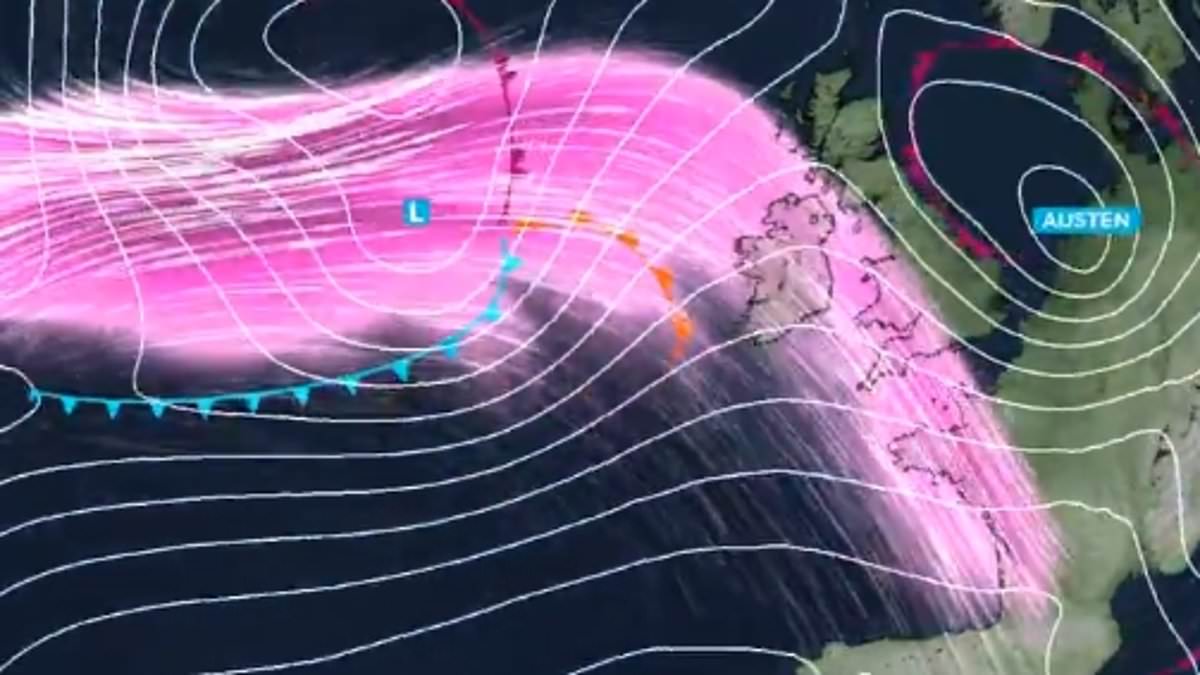
Published: 05:18 EDT, 22 October 2026 | Updated: 06:05 EDT, 22 October 2026 The Met Office has extended wind warnings to cover London tomorrow as Britain's first named storm of the season is set to bring damaging winds and travel disruption.Forecasters have issued an amber wind warning for the far South West ahead of Storm Austen's arrival, as well as yellow warnings for much of the rest of England.The amber warning is in place from 1am to 10am tomorrow for Devon and Cornwall, where gusts of 60 to 70mph will develop with some exposed areas expecting 80mph.Power cuts may affect homes, while some buildings may be damaged and a 'danger to life' is likely from large waves and beach material being thrown onto coastal roads.A yellow warning for wind is in place for a wider region of the South West as well as South Wales and along England's South Coast between midnight and 5pm tomorrow.Strong winds are expected to spread across southern England tonight and tomorrow, with gusts of 50 to 60mph likely and some exposed areas seeing 70mph or above.Another yellow wind warning has been issued for the South East including London, as well as the Midlands and parts of the North West, from 10am to 9pm tomorrow.While these winds will not be as strong as those further south and west, a spell of inland gales is possible with gusts around 45 to 55mph during the day tomorrow. The Met Office has issued a series of yellow and amber weather warnings for tomorrow Pedestrians on London Bridge caught in a heavy rain shower yesterday ahead of Storm AustenA yellow warning for rain has been issued in parts of Scotland from 6am tomorrow until 3am on Saturday, where accumulations of 20 to 40mm are expected widely.Up to 60mm to 80mm is also possible in some locations, bringing flooding and travel disruption – with a chance some communities 'will become cut off by flooded roads'.Meteorologists tracking Storm Austen in the Atlantic Ocean have confirmed the low pressure system is undergoing explosive cyclogenesis, known as a 'weather bomb'.A weather bomb is officially declared when the central atmospheric pressure of a low pressure system rapidly falls by at least 24 millibars within a 24-hour period.Met Office senior operational meteorologist Marco Petagna said the pressure will fall by 24mb in just 18 hours, from 1004 mb to 980mb - therefore within the threshold.Met Office deputy chief forecaster Chris Bulmer said: 'Storm Austen is expected to bring a spell of impactful weather to parts of the UK from Thursday night and through Friday.'While there remains some uncertainty in the exact track of the storm, there is increasing confidence in the potential for disruptive winds across parts of southwest England, which is why an amber warning has been issued.'Winds gusts could potentially reach 60 to 70 mph for a time, and these strong winds will be combined with spells of heavy rain. The amber warning for wind is in place from 1am to 10am tomorrow for Devon and Cornwall A yellow warning for wind is in place for a wider region between midnight and 5pm tomorrow Another yellow wind warning has been issued for the South East from 10am to 9pm tomorrow A yellow rain warning has been issued in Scotland from 6am tomorrow until 3am on Saturday The Met Office has said Austen, Boelo and Chloe will be the first named storms of the season'People in affected areas should keep up to date with the latest forecast and warnings as the event develops.'The Met Office said the weather is expected to remain unsettled through the weekend and into next week while low pressure is likely to bring strong winds to northern parts of the UK on Saturday and Sunday.Ross Macleod, RNLI water safety manager, has asked people not to take 'unnecessary risks' when visiting the coast.He said: 'If you plan to visit the coast or a waterside location, we urge you stay a safe distance from the water as conditions could knock you off your feet or wash you into the sea.'The Met Office storm year runs from September to August, with each 12-month period having its own alphabetical list of names that are used to label successive storms.This year's list begins with Austen and continues with Boelo, Chloe, Dano and Evelyn, ending at W with Wende.Storm naming is a partnership between the Met Office, Ireland's Met Éireann and the Dutch service KNMI.Met Éireann selected the name for the first storm in honour of Austen Nagle, the Irish Meteorological Service's first director.
Met Office issues wind warning for London as Storm Austen to batter Britain with 80mph gales in October half-term
Full Article
Original Source
Read the full article at Dailymail →KhanList aggregates and links to publicly available news content. We do not host full articles from third-party sources. Always verify important information with original sources.