
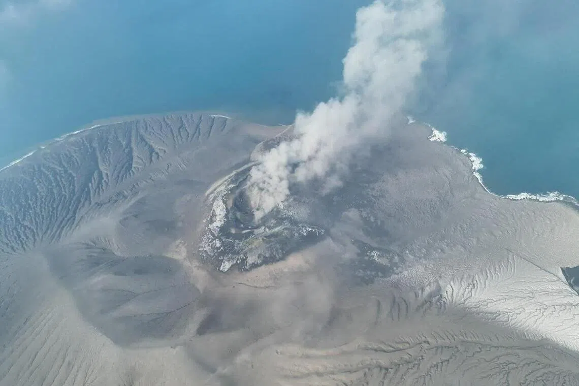
Two new islands have appeared off Anak Krakatau in Indonesia, potentially the first in nearly a century to emerge within the caldera left by Krakatoa’s catastrophic 1883 eruption.The formations, discovered following a 25-hour eruption in early September, sit hundreds of metres off opposite sides of Anak Krakatau – one to the north-west and the other to the south-east – almost on a straight line through the volcano’s crater, according to Indonesia’s Geological Agency. The agency places one about 760m off Anak Krakatau’s north-west coast and the other some 495m to the south-east. It has not verified their dimensions or elevation above sea level. The agency’s preliminary interpretation is that relatively fluid magma released during the continuous eruption reached the surface via an elongated northwest-southeast opening, with erupted material forming two island-like mounds offshore.For 96 years, the caldera’s story has been the making and remaking of Anak Krakatau in the Sunda Strait between Java and Sumatra. No other separate island is known to have emerged in the caldera since Anak Krakatau became permanently established above sea level in 1930.The most striking public glimpse of either feature came by accident nearly two weeks after the eruption, as volunteers searched for a group of journalists and others missing at sea. Yodistara Nugraha, a tourism activist from Kalianda, South Lampung, spent the day flying a drone over shorelines and shallow water around the caldera looking for any signs of them or their speedboat, which had disappeared on a reporting trip to Anak Krakatau.In footage from his final flight of the day, the drone crossed the channel between Sertung island and Anak Krakatau, where it captured waves breaking over a low, dark mass. The footage appears to show the new northwestern island.The search found no trace of the missing group and it was only afterwards that Yodistara realised he may have documented a geological event.“I didn’t realise at first that I might have captured something new,” he said in an interview with Bloomberg News. “It was only later I understood how interesting and potentially significant the footage could be.”Anak Krakatau – or ‘Child of Krakatoa’ – had been quiet for more than two years until activity resumed in July. That culminated in 25 hours of continuous eruption beginning late on Sept 4, with lava flows and pyroclastic material adding nearly 33ha to the island’s area, according to the Geological Agency.Weeks later, the agency received reports of new island-like formations from mariners and volunteers who had sailed through and photographed the area, it said. The formations are also visible in Sentinel satellite imagery since the eruption.The agency has released annotated Sentinel imagery marking the two sites with red triangles, but no clear close-up images of the formations themselves. Heruningtyas Desi Purnamasari, who heads a volcano team within the agency, said key questions about the landmasses remain unresolved.“At this stage, we cannot confirm the origin or composition of the two features based on satellite imagery alone,” she said.“In particular, we cannot yet confirm whether volcanic material was directly erupted at these locations or whether they represent new eruptive vents.”One of the key questions is what the formations are made of, said Asri Oktavioni Indraswari, an assistant professor in the Geosciences Department at the University of Indonesia.“There are two possibilities: new vents or eruption materials just piling up in the shallow part of the old caldera,” she said. “If they’re new vents where magma is erupting, that would mean activity is no longer confined to Anak Krakatau’s central conduit.”Anak Krakatau emerged decades after the massive 1883 eruption of Krakatoa that destroyed most of the original island, killed more than 36,000 people and affected climate and skies worldwide for years. The explosions were heard almost 5,000km away, while pressure waves circled the globe multiple times. Telegraph links turned the disaster into one of the first global news events.Whatever the origin of the new landmasses, their survival as islands will depend on whether they remain above water at high tide and withstand erosion.Anak Krakatau itself took multiple attempts to become an island. The first clearly observed submarine eruptions at the site began in late 1927. Erupted material initially broke the surface in 1928, then disappeared beneath the waves. The sequence repeated until the island was finally established in 1930.“Landforms around volcanoes close to sea level can be very dynamic environments, with erosion and transport of material – particularly loose material deposited from explosive volcanism – competing with deposition and growth during eruptive activity,” said Sebastian Watt, a professor of volcanology at the University of Birmingham.“The form of the island changed a lot in those early years,” he said. “It was composed of loose material produced by explosive eruptions, which deposited material on the seafloor and then gradually built up the landmass around the vent, eventually emerging above sea-level. This material was then eroded outside eruptive periods, so the landmass appeared and then disappeared.”The island’s appearance can change in a flash. In December 2018, a major flank collapse and eruption cut its peak from more than 330m to roughly 110m. A July Geological Agency report put its peak at about 157m.“We still see this pattern around Anak Krakatau today,” Watt said. BLOOMBERG
Indonesia’s Anak Krakatau volcano spawns two new islands after eruption, first since 1930
Full Article
Original Source
Read the full article at Straitstimes →KhanList aggregates and links to publicly available news content. We do not host full articles from third-party sources. Always verify important information with original sources.