
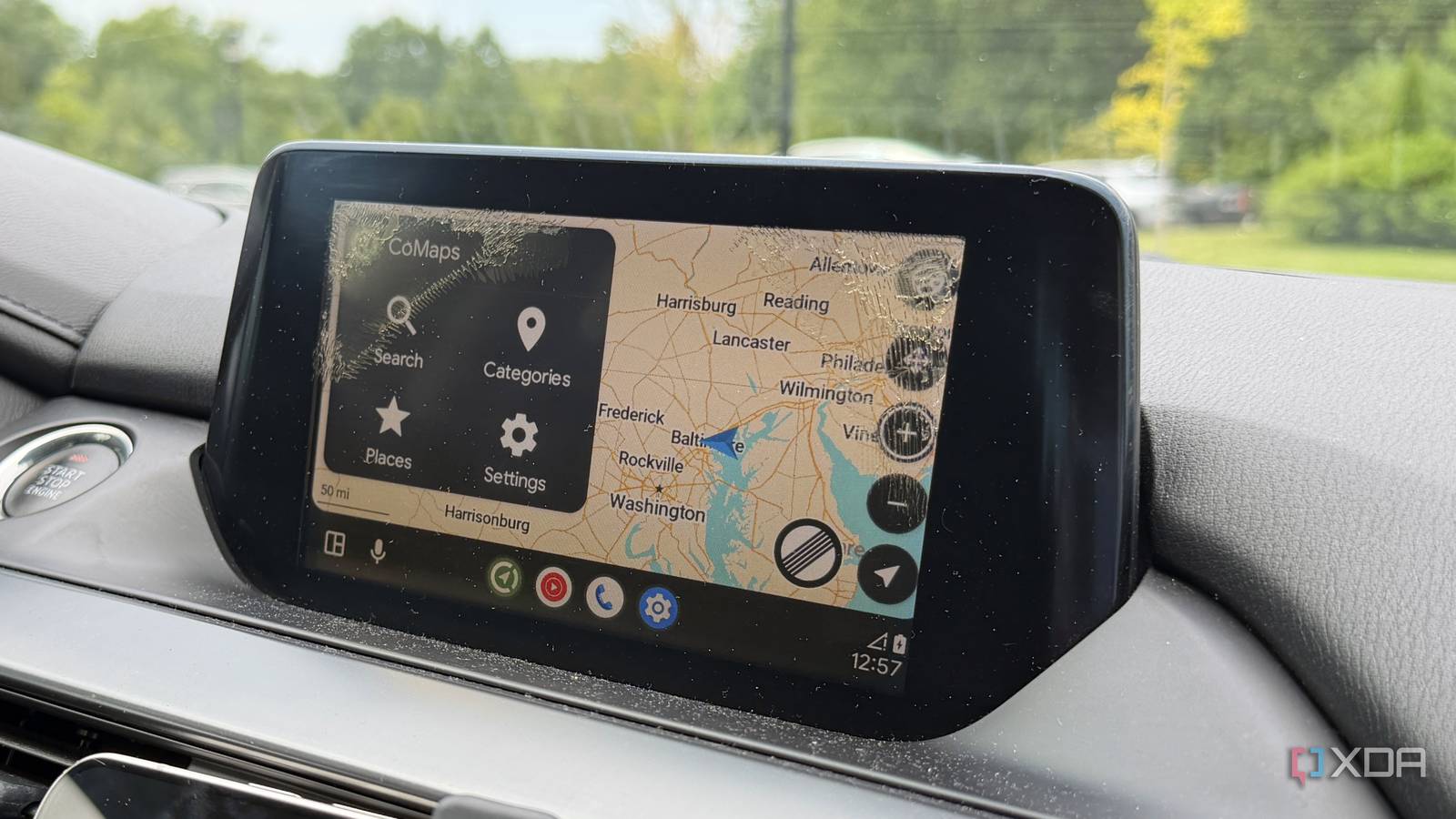
Published Sep 3, 2026, 8:30 AM EDT Maker, meme-r, and unabashed geek, Joe has been writing about technology since starting his career in 2018 at KnowTechie. He's covered everything from Apple to apps and crowdfunding and loves getting to the bottom of complicated topics. In that time, he's also written for SlashGear and numerous corporate clients before finding his home at XDA in the spring of 2023. He was the kid who took apart every toy to see how it worked, even if it didn't exactly go back together afterward. That's given him a solid background for explaining how complex systems work together, and he promises he's gotten better at the putting things back together stage since then. Android Auto has been my co-pilot on the Mazda6's infotainment ever since I ran a new USB cable for it, and mostly I let Google Maps handle directions without a second thought. It's the default; it anchors every list of useful Android Auto apps, and with a signal, it's still the best. The trouble is that last clause. Google Maps assumes you have data, and the moment you don't, it goes from co-pilot to passenger with a dead phone. So, I've switched to CoMaps for most of my driving, as it treats areas of no signal as the default, not as the emergency. I've tried using Google Maps in offline mode and haven't had much success, whether that's because of my car system or just the area I live in. The point is that I always loved having offline maps when I had a dedicated GPS navigation box, and I wanted that simplicity back on Android Auto. Android Auto's default navigation has been losing my trust The map isn't the problem, but search and rerouting are Google likes to pretend that signal quality is a solved problem, but that really depends on the quality of the cellular network near you. My regular drives go through two under-sea tunnels, back roads where the farmers petitioned against new cell towers, and large downtown buildings that like to knock out my signal. That makes Google Maps less useful for long stretches of the day, and I dread having to drive into town because of it. It's a pain, whether it's map tiles not loading or not being able to reroute me when I miss a turn. I still need to use Android Auto, as it locks the touchscreen when in use on my Mazda6, which fixes the ghost touches from the touchscreen layer breaking down, but I'm not putting up with the lack of usable offline maps anymore. I switched to CoMaps and I'm much happier Just remember the Google Play Store version is the only one that works in Android Auto CoMaps is the community fork of Organic Maps, started in mid-2025 by its own contributors after a falling-out over governance. The fork stripped out the Kayak affiliate links and Google Firebase dependencies that Organic Maps had picked up, and every decision now happens in public on Codeberg. It's built on OpenStreetMap data, with no account, no ads, no subscription, and no tracking, which I'll admit made me a little suspicious at first. The catch is that it's less polished than Google Maps, and that's a trade I'll take. The setup is about as short as these things get: Setting it up is like any other navigation app. Just make sure you're downloading it from the Play Store; otherwise, it won't work with Android Auto. Before you leave the house, open the app and download any regions you regularly drive through, because downloading several hundred megabytes of data over cellular is no fun, plus it defeats the point of having an offline map. Yes, it's available on F-Droid and Codeberg, but you don't want to use those versions on your car's screen. It's fine if you plan on using your phone as the display, but Android Auto checks which package installed the app, and only the Google Play installer ID will pass that check. Like Google Maps, you get a stripped-down version of the phone app. It reminds me much more of 2010s standalone devices than of recent navigation, but that's fine. Not like you want distractions while driving anyhow. CoMaps CoMaps is a privacy-focused, open-source navigation app offering offline maps, turn-by-turn directions, and detailed location data without tracking users or relying on an internet connection. Living with an offline-first navigation app Sure you have to make some adjustments but it's worth it The change is less about what CoMaps does and more about what it never asks for. It never shows a 'waiting for network' spinner. It never loses the route when the phone drops to one bar. Search works in a parking garage with zero signal because the search index is on the phone, and rerouting after a missed turn is instant for the same reason. Okay, maybe I'm overselling the serenity a little. What actually happened is that a small background worry went away, and I only noticed when I drove through the dead zone that nothing happened. I can deal with that, especially downtown, where the buildings make Google Maps flicker between two parallel roads instead of staying on the one I'm actually driving on. I did have to get used to live traffic not being available, but that's been a little glitchy on Google Maps anyway. Plus, it's Maryland. I know there will be road construction on my route no matter where I drive, and there's guaranteed to be at least one radar-enforced speed-limit section because that's what pulls in tax dollars. Even at 2am, I can guarantee there will be heavy traffic somewhere, so I always plan for extra travel time. CoMaps uses OpenStreetMap data, so it doesn't always include all local businesses. The number of times I've actually needed to find anything other than a gas station in the last year is zero, so I don't really care if I can't find the closest restaurant as I drive past. The only thing I miss is lane guidance, which is iOS-only right now, but I'm sure it'll turn up on the Android app at some point. Google Maps offline maps work but they're my fallback Offline search and rerouting through Android Auto are weak points in the system Some days, I don't always have the best signal on my phone, especially when it's in the handover area between my home Wi-Fi and cellular. I've always got the local area saved as offline maps in Google Maps, just in case, and I'm glad to have the map because Baltimore treats the grid system as a suggestion, even downtown. It's a safety net, even if I have to remember to toggle auto-updates on so they don't auto-delete after a year. I don't like that it only lets me draw a rectangle to download when on my phone, or that I have to zoom way too far out to get the local roads included, but at least it's there. But when I'm forced offline, using Maps through Android Auto often fails to let me search for the most basic of landmarks. That's without even leaving the driveway, and it gets worse when rerouting doesn't always happen while driving. These are such basic elements of a GPS navigation system that I'd go back to my in-car system if it would let me listen to my podcasts. Offline first should have been the default for Android Auto The fix for my navigation problem wasn't a better map. It was an app that assumed the network was optional rather than assuming it was there. Google Maps could have been that app, and its offline mode proves the pieces exist, but it's built for the connected case first. CoMaps is built for the disconnected case first, and it turns out that's the case that actually bites you in a car.
I stopped using Android Auto's navigation and switched to offline maps, and now I never worry about signal loss
Full Article
Original Source
Read the full article at Xda-developers →KhanList aggregates and links to publicly available news content. We do not host full articles from third-party sources. Always verify important information with original sources.