
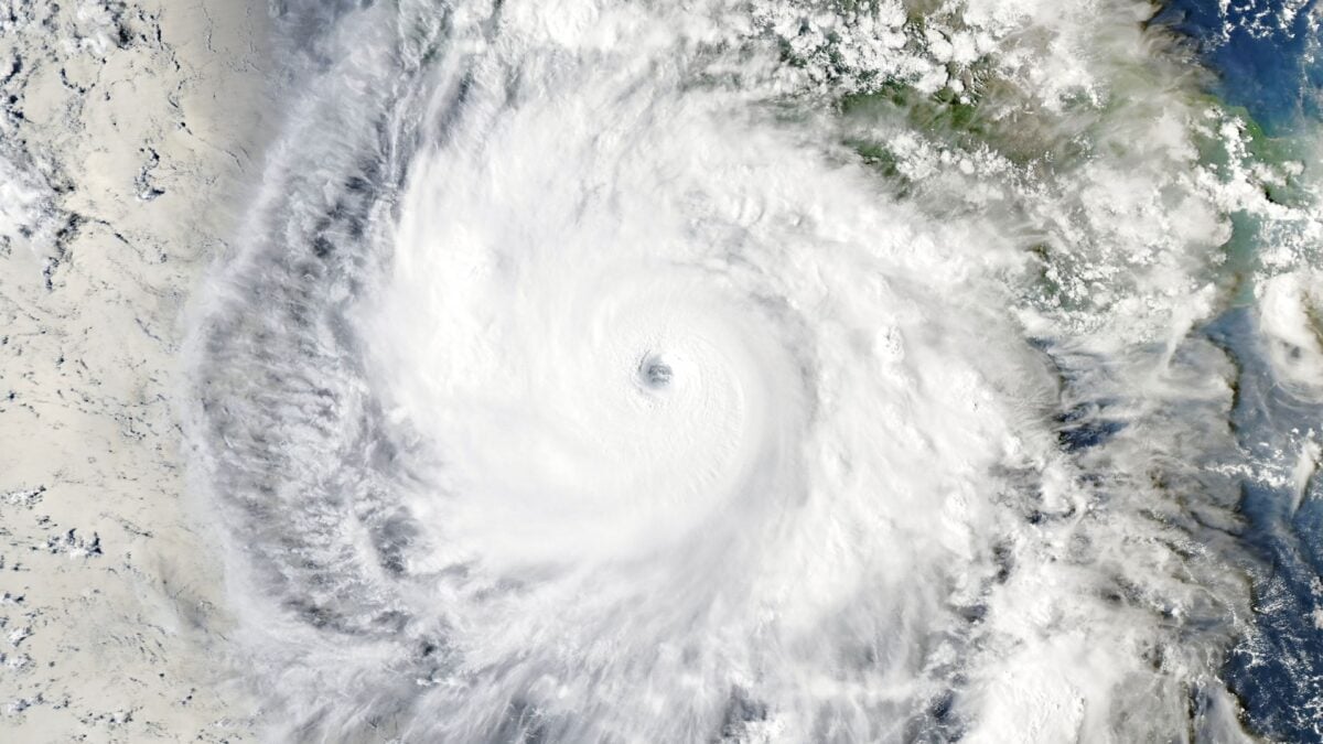
Last week, a tropical storm off the Pacific coast of Mexico exploded into a Category 5 hurricane in just 24 hours, undergoing one of the most rapid bouts of intensification on record in the eastern Pacific and leaving meteorologists gobsmacked. Some described the storm’s development as “jaw-dropping,” “truly remarkable,” and even “absolute insanity.” Polo has since weakened, but it is still a major Category 3 hurricane. It’s set to make landfall on the west coast of the Baja California Peninsula in northern Mexico today, bringing life-threatening storm conditions to Baja California Sur. Forecasters at the National Hurricane Center expect Polo to dissipate before it reaches the United States, but starting Monday, remnants of this storm and the post-tropical cyclone Odalys could bring a significant flood threat to the Southwest. “Copious amounts of moisture will surge into the Desert Southwest and eventually the Southern Plains and Texas,” meteorologist Matt Lanza wrote in a blog post on Sunday. A WIDESPREAD FLASH FLOOD THREAT will push into the Southern High Plains on Tuesday as remnant energy from Hurricane Polo fuels widespread heavy rain…. The heavy rainfall event currently pounding the Southwest will shift southeastward on Tuesday. As the remnant mid-to-upper… pic.twitter.com/aWVCHOm5nU — Max Velocity (@MaxVelocityWX) September 28, 2026 The National Weather Service has issued flood watches across the Four Corners region, including parts of New Mexico, Arizona, Texas, Utah, and Colorado. NWS forecasters expect some areas to receive up to four inches (10 centimeters) of rain in the next couple of days. In many places, burn scars left over from a summer of brutal wildfires, saturated soils from heavy rain last week, or extreme drought conditions will exacerbate the risk of flash flooding. According to Washington Post meteorologist Ben Noll, moisture-rich air will expand into the central U.S. Tuesday through Friday, potentially generating some thunderstorms and a few tornadoes. Lanza reports that rain totals could range from four to eight inches (10 to 20 cm) from south of San Antonio through Dallas, Texas, and potentially up to Durant, Oklahoma by Friday. “There is a chance that some areas see as much as 10 to 12 inches though, as we know Texas flood history is littered with these types of remnant Pacific hurricane events,” Lanza wrote. Pacific hurricane season keeps on churning Hurricane Polo is one of three active cyclones spinning in the Pacific right now. This is actually the second time this month that the Pacific has whipped up three cyclones at once. Forecasters are also eyeing a disturbance located well east-southeast of Hawaii with a 90% chance of cyclone formation in the next week. It has indeed been a record-breaking Pacific hurricane season. To date, 20 named storms have formed across the central and eastern Pacific basins, seven of which were major hurricanes. Extremely high sea surface temperatures driven by a historically strong El Niño are largely to blame, as all that extra heat provides more energy to help cyclones organize and strengthen. Fortunately for the United States, hurricanes don’t tend to make landfall on its Pacific Coast. It’s mostly the Atlantic hurricanes Americans have to worry about, but El Niño suppresses cyclone formation in the Atlantic ocean. That would explain why the U.S. has yet to see a landfalling hurricane this year. But storms like Hurricane Polo serve as reminder that cyclones don’t need to make landfall to have a major impact on U.S. weather.
Hurricane Polo Will Hit the US Hard Without Making Landfall
Full Article
Original Source
Read the full article at Gizmodo →KhanList aggregates and links to publicly available news content. We do not host full articles from third-party sources. Always verify important information with original sources.