
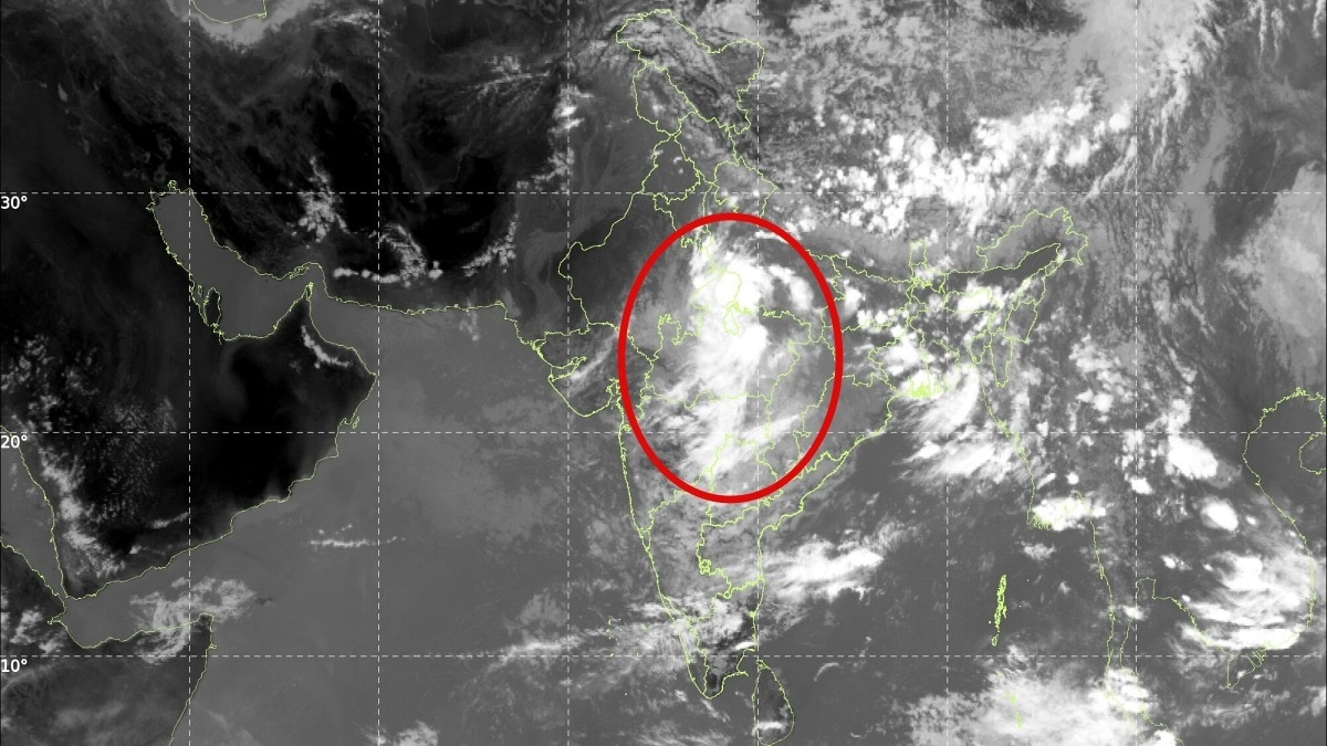
A westward-moving low-pressure system has spread dense rain clouds across Madhya Pradesh and nearby states. The fresh monsoon surge could bring heavy showers and test whether seasonal rainfall deficits can still narrow.The renewed burst of rainfall activity is being driven by the westward movement of a low-pressure system. (Photo: IMD)Central and eastern India are set for another spell of widespread rain as a significant increase in monsoon activity brings dense cloud cover and the possibility of heavy showers across Madhya Pradesh and neighbouring states.Satellite imagery from the India Meteorological Department (IMD) on Thursday showed massive rain-bearing cloud formations stretching across parts of central India, with Bhopal, Indore, Jabalpur and surrounding regions emerging as key areas to watch.The renewed burst of rainfall activity is being driven by the westward movement of a low-pressure system (LPS), which has strengthened the monsoon circulation and triggered the formation of extensive convective clouds over central and eastern parts of the country. The latest satellite picture shows a large concentration of dense clouds over Madhya Pradesh and adjoining regions, indicating favourable conditions for moderate to heavy rainfall at several places.The system is also expected to influence weather over parts of Chhattisgarh, Uttar Pradesh, Bihar and eastern India. Meteorologists say the development comes at an important stage of the monsoon season, which appears to be making one final push before its eventual withdrawal. The southwest monsoon has shown considerable variability across India this season, with some regions receiving excess rainfall while others continue to grapple with deficits.The next two weeks could prove crucial in determining whether the monsoon can reduce rainfall shortages in parts of the country.IMD's state-wise rainfall map for the period between June 4 and September 2 highlights this uneven distribution. While several central and eastern states have received normal or excess rainfall, large parts of northwest and peninsular India remain rain-deficient.Madhya Pradesh, however, has broadly remained in the normal rainfall category, and the latest weather system could add substantially to its seasonal total.The cloud build-up over central India has raised the possibility of intense spells of rain, particularly where moisture-laden monsoon winds converge with the low-pressure circulation. Urban centres such as Bhopal and Indore could witness periods of heavy rainfall, accompanied by thunderstorms and strong gusty winds.Jabalpur and other parts of eastern Madhya Pradesh are also likely to remain under the influence of the active weather system.The revival is part of a broader resurgence of monsoon activity across eastern and central India, where atmospheric conditions remain favourable for sustained cloud formation and rainfall.For now, the monsoon appears to be refusing to give up. With the low-pressure system moving westward and rain clouds continuing to expand over the heart of India, the coming days could bring another wet and potentially intense chapter to the 2026 monsoon season.- EndsPublished By: Sibu Kumar TripathiPublished On: Sep 3, 2026 15:49 IST
Heavy rain to drench Central India: Massive rain clouds shroud Bhopal, Indore
Full Article
Original Source
Read the full article at Indiatoday →KhanList aggregates and links to publicly available news content. We do not host full articles from third-party sources. Always verify important information with original sources.