
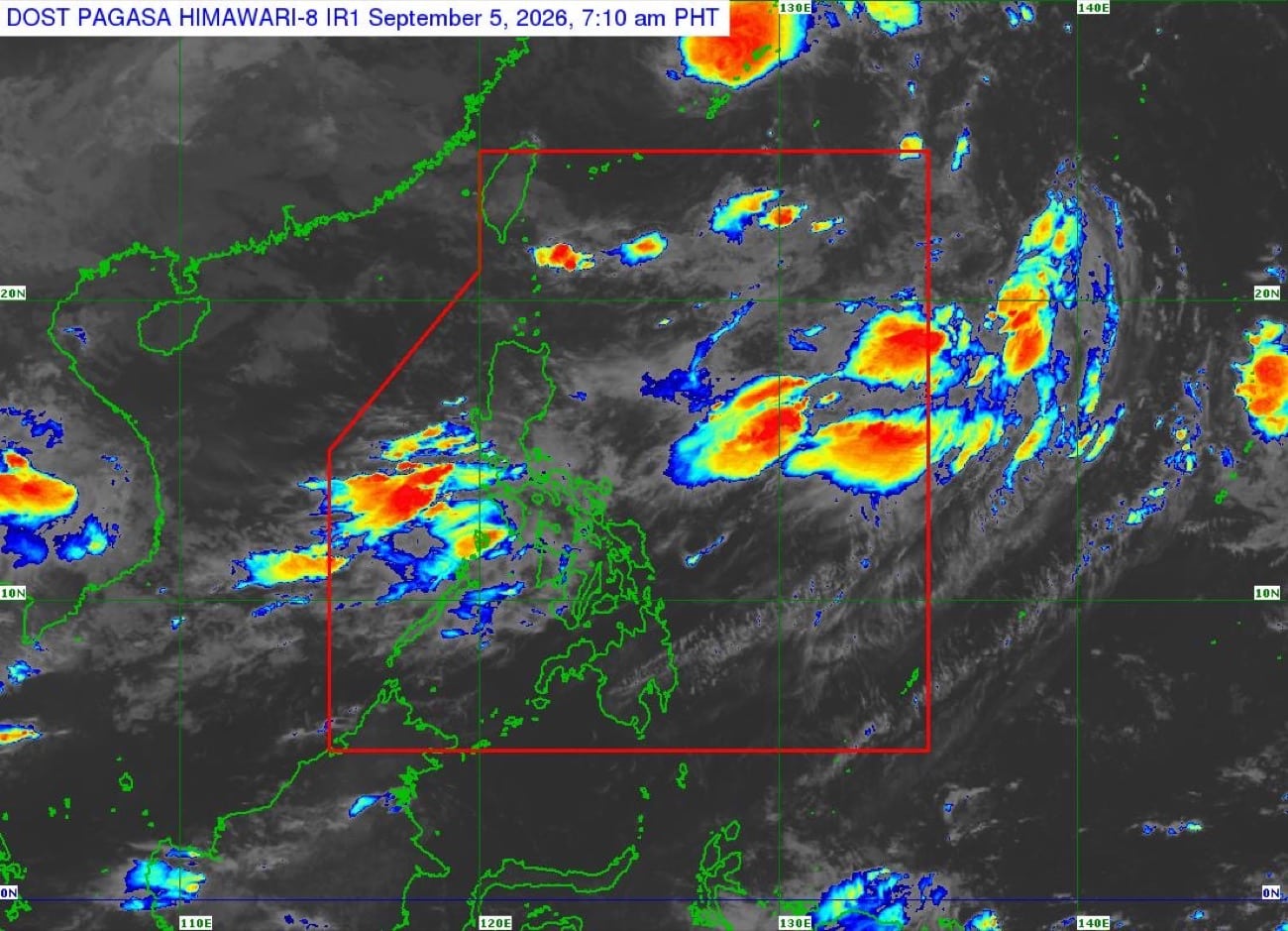
Image from Pagasa MANILA, Philippines — Heavy rains will continue over several parts of Luzon and Visayas on Saturday amid the effects of the southwest monsoon, locally known as habagat, the state weather bureau said. According to the Philippine Atmospheric, Geophysical, and Astronomical Services Administration (Pagasa) in its latest forecast, monsoon rains—or continuous heavy rain brought by the habagat—will prevail over Occidental Mindoro. READ: Pilandok won’t directly affect PH but habagat to prevail Article continues after this advertisement Occasional rains are also forecast in Metro Manila, Zambales, Bataan, Tarlac, Pampanga, Bulacan, Rizal, Cavite, Batangas, Laguna and Oriental Mindoro. Cloudy skies with chances of rain are then forecast over Abra, Benguet, and the remaining parts of Central Luzon, Calabarzon, Mimaropa and Bicol Region. “Sa nalalabing bahagi naman ng Luzon, asahan ang pagbuti ng panahon, o partly cloudy to cloudy skies,” said Pagasa weather specialist Veronica Torres. (As for the rest of Luzon, expect improving weather conditions, or partly cloudy to cloudy skies.) Meanwhile, occasional rains are likewise forecast in Antique, while cloudy skies and scattered rain showers are also expected to affect Western Visayas and Northern Samar. Article continues after this advertisement Relatively fairer weather, on the other hand, are forecast over the rest of Visayas and the entire Mindanao, with and hot and humid temperature expected. Expected rainfall amount With the effects of habagat, 100 to 200 millimeters (mm) of rain are expected to pour over Occidental Mindoro. Article continues after this advertisement Due to this, numerous flooding events are likely especially in areas in Occidental Mindoro that are urbanized, low lying or near rivers, while landslides are likely in moderate to highly suscpetible areas. At the same time, 50 to 100 mm of rain are forecast over Zambales, Tarlac, Pampanga, Bulacan, Rizal, Metro Manila, Cavite, Laguna, Batangas, Oriental Mindoro and Antique. Under these conditions, localized flooding is possible especially in areas that are urbanized, low-lying and near rivers, while landslide is possible in highly susceptible areas. Other weather systems A tropical depression located 1,685 kilometers (km) east northeast of Extreme Northern Luzon is also being monitored outside the Philippine area of responsibility (PAR), carrying maximum sustained winds of 55 km per hour (kph) and gustiness of up to 70 kph. Thankfully, Pagasa noted that its chances of entering PAR are becoming less and less as it continues to move northward at 35 kph. Your subscription could not be saved. Please try again. Your subscription has been successful. However, Pilandok, who has already left both PAR and the country’s monitoring domain, may once again enter PAR on Sunday. /mr
Habagat rains to drench parts of Luzon, Visayas on Saturday
Full Article
Original Source
Read the full article at Newsinfo →KhanList aggregates and links to publicly available news content. We do not host full articles from third-party sources. Always verify important information with original sources.