
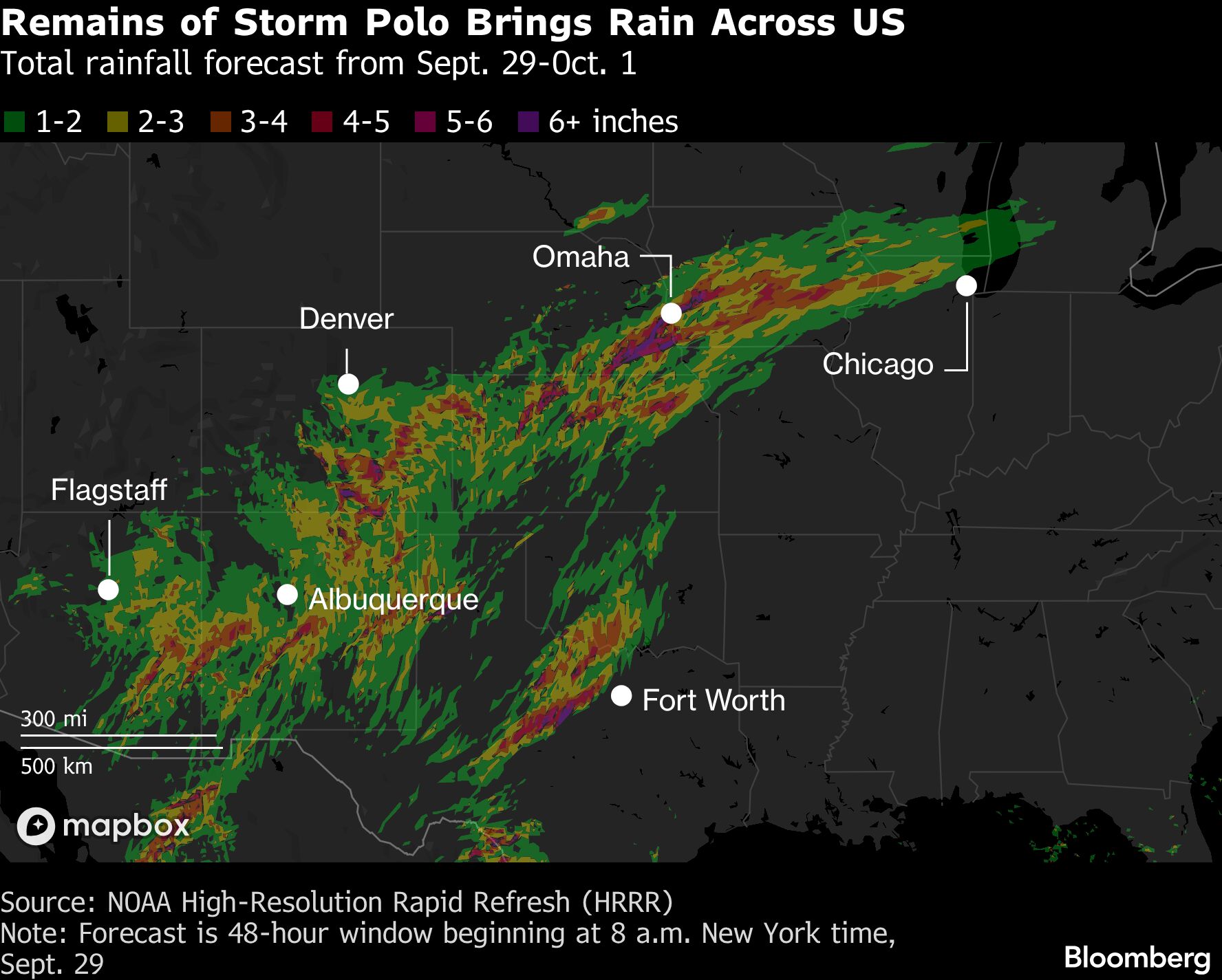
Remnants of Hurricane Polo are set to fuel a widespread flood threat across the US from the Southwest to the Midwest in coming days. Heavy rain from the storm has already caused flash flooding in parts of Utah and Nevada, said Marc Chenard, a senior branch forecaster at the US Weather Prediction Center. Tropical moisture will combine with another low-pressure system moving in from the Pacific to bring torrential rain across a large swath of the US over the next three days. Flood watches are in effect across parts of the Southwest and Plains, including Phoenix and Dallas. “Those two features combined will bring a pretty wide flood threat spread into the Plains,” Chenard said. “There is a pretty big foot print of heavy rain for Kansas, Nebraska, Iowa and Illinois, into the southern plains to Texas.” The Weather Prediction Center has a moderate risk, level 3 of 4, of excessive rainfall across Arizona and New Mexico, as well as parts of Texas, Oklahoma, Colorado and Kansas, on Tuesday. On Wednesday and Thursday, the highest threats shift to Oklahoma and Texas, including Dallas. The central US has already endured a summer of deadly flooding, evacuations and prolonged power outages. Now an El Niño-charged Pacific has produced a string of powerful storms, bringing deluges from Mexico and Hawaii into the contiguous US. Over the next five days, parts of the Great Plains and Midwest, including the Corn Belt, may receive as much as 5 inches (13 centimeters) of rain. Polo landed overnight as a Category 2 storm on the five-step Saffir-Simpson scale, with top winds of 110 miles (175 kilometers) per hour. No deaths have been reported so far, and communities where the storm made landfall were spared from major damages overnight, Baja California Sur Governor Victor Manuel Castro said in a press conference Tuesday morning. The storm is on track to make a second landfall in Guaymas, Sonora, this morning between 8 a.m. and 9 a.m. local time as a weaker Category 1 storm. Forecasters at the US National Hurricane Center have said that as much as a foot of rain (30 centimeters) may fall along the coast with up to 8 inches possible in southern and central Sonora. Beyond flooding, the rains carry a risk of mudslides through steep and rocky terrain. Mexico has deployed about 7,000 military personnel and prepared over 150 temporary shelters in Baja California Sur. Beach access has also been restricted around San José del Cabo as dangerous surf builds, extending weather-related disruptions along Mexico’s Pacific coast after earlier flooding and mudslide warnings in Guerrero and Michoacán. Copyright 2026 Bloomberg. Topics Flood
Flood Watches Stretch From Phoenix to Dallas on Polo Remnants
Full Article
Original Source
Read the full article at Insurancejournal →KhanList aggregates and links to publicly available news content. We do not host full articles from third-party sources. Always verify important information with original sources.