
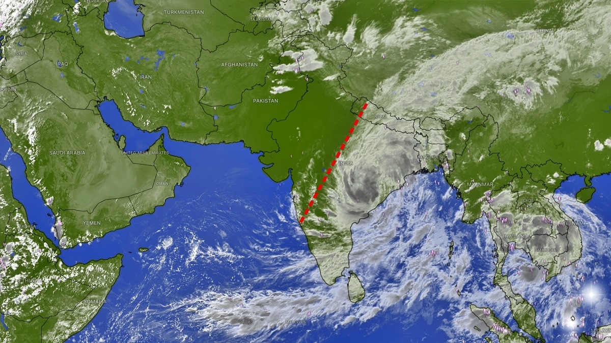
An INSAT-3DS satellite image showed dense cloud cover over central, eastern and southern India, with clearer skies over the northwest. The contrast coincided with a weakening deep depression.The picture is particularly interesting because it comes near the end of the southwest monsoon season. (Photo: Windy)New Delhi,Sep 25, 2026 08:00 ISTA striking satellite image has captured a dramatic contrast over India, with thick clouds covering large parts of the central, eastern and southern regions while much of northwest India remains comparatively clear.The image, captured by India’s INSAT-3DS satellite in the thermal-infrared channel at a wavelength of 10.83 micrometres on September 24, shows an extensive cloud field stretching across the Indian subcontinent and into neighbouring parts of South and Southeast Asia.The brightest regions in the infrared image represent colder, higher cloud tops. Such clouds are often associated with deep convection and can produce heavy rainfall, particularly when they are linked to an active weather system.The contrast is particularly striking across India. A broad area of cloud cover extends from central India towards the east and northeast, while relatively clearer skies dominate parts of Rajasthan, Gujarat and the northwestern region. The cloud pattern comes as a deep depression over north coastal Andhra Pradesh and adjoining south Odisha continues to move inland. The system has been responsible for widespread rainfall across Odisha, Chhattisgarh and neighbouring regions, with the India Meteorological Department warning of heavy to very heavy rain and isolated extremely heavy rainfall in parts of eastern and central India.As the system weakens while moving northwestwards, its circulation is expected to continue driving rainfall over parts of central India. The satellite image also captures extensive cloud bands over the Bay of Bengal and surrounding regions, showing how moisture is being transported into the Indian landmass.The picture is particularly interesting because it comes near the end of the southwest monsoon season. The monsoon has already begun withdrawing from parts of northwest India, but weather systems over the Bay of Bengal can continue to generate heavy rainfall over central and eastern India.The apparent “divide” in the satellite image, therefore, is not a physical boundary. It reflects the sharp contrast between areas under active clouds and convection and regions where the atmosphere has become relatively drier and clearer.With the deep depression weakening, the cloud pattern is expected to evolve rapidly over the next 24-48 hours.- Ends
Dry on one side, rain on the other: India's dramatic weather divide captured
Full Article
Original Source
Read the full article at Indiatoday →KhanList aggregates and links to publicly available news content. We do not host full articles from third-party sources. Always verify important information with original sources.