
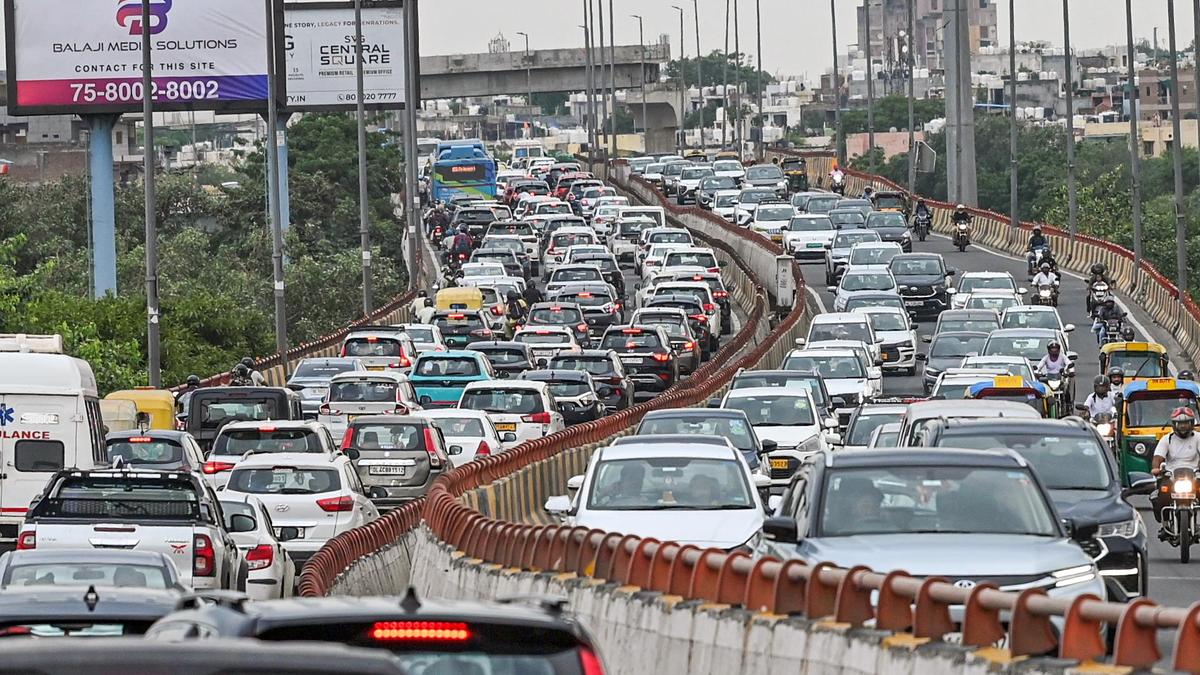
Heavy traffic congestion near the Barapullah flyover in New Delhi. | Photo Credit: ANI Faced with persistent traffic congestion — ranging from long queues on National Highway-48 backing up towards Gurugram to snarls at Dhaula Kuan and Mathura Road — Delhi Traffic Police has proposed a comprehensive restructuring of traffic management in the New Delhi Traffic Range, with the aim of reducing congestion and travel time by 15-20% on major corridors.According to a proposal seen by The Hindu, the New Delhi Traffic Range is likely to be expanded from 11 to 15 traffic circles, with jurisdictional boundaries being redrawn so that the same traffic unit can manage both ends of key roads and flyovers. The proposed new circles include Dhaula Kuan, Kartavya Path, Jantar Mantar and Safdarjung Enclave.The traffic range, which comprises New Delhi and South West districts, faces unique challenges — ranging from frequent VIP movements and security restrictions around government establishments to heavy commuter and airport-bound traffic. The proposed changes seek to improve coordination across these busy stretches while minimising inconvenience to regular commuters during traffic restrictions and major events.The move is aimed at resolving situations where traffic entering a stretch from one road or flyover falls under a different circle than the road receiving it, which complicates coordination and hampers effective management of traffic flow.One of the key stretches identified in the proposal is the Dhaula Kuan flyover, a critical junction linking NH-48, the Ring Road, Sardar Patel Marg and Vande Mataram Marg. At present, the flyover falls under the South West traffic district. Under the new plan, it is proposed to be brought under a dedicated Dhaula Kuan circle along with Sardar Patel Marg. The restructuring is intended to enable traffic personnel to manage vehicular movement across the entire junction in a unified manner, instead of tackling congestion in separate jurisdictions.“Bringing the relevant stretches under a single traffic unit will enable the traffic inspector to monitor and regulate flow on both sides — incoming as well as outgoing — rather than dealing with congestion at one point in isolation,” an official privy to the development said.The need for better coordination is particularly evident on NH-48, where the eight-lane highway narrows to less than four lanes on approaching Sardar Patel Marg. This abrupt drop in road capacity leads to long queues on the highway, with congestion spilling over towards Gurugram and choking the Mahipalpur and Shiv Murti junctions.Under the proposed arrangement, personnel from the same circle would be stationed at both ends of the Dhaula Kuan flyover to closely regulate vehicular movement and respond swiftly to bottlenecks as they develop.A similar approach has been proposed for Mathura Road towards Sarai Kale Khan, where congestion around a CNG pump creates a major bottleneck. As part of the other jurisdictional changes, the Rao Tula Ram (RTR) flyover and Old Palam Marg, which currently fall under the Delhi Cantonment and Safdarjung Enclave circles respectively, could be brought under the Vasant Vihar circle. Janpath and Raisina Road are also proposed to be brought under a new Jantar Mantar circle.Alongside the jurisdictional restructuring, the proposal also calls for augmenting manpower in the area from around 1,000 personnel to over 1,800. It also recommends bringing down the average age of personnel deployed, given the physically demanding nature of field duties, and strengthening mobile patrolling teams to ensure swift response to congestion and road obstructions.Other measures proposed include identifying the 10 most congested locations in each traffic circle, putting in place a 15-minute response mechanism for major obstructions, tightening parking enforcement and reviewing signal timings. The plan also calls for mapping accident-prone stretches, tracking daily traffic performance and congestion levels, improving pedestrian safety, and upgrading around 75 priority bus stops with better lighting, safer boarding and deboarding facilities and visible police presence.The Sardar Patel Marg–IGI Airport route is proposed to be developed as a priority mobility corridor, with a focus on quicker clearance of broken-down vehicles and other obstructions to ensure smoother airport connectivity. Published - October 27, 2026 08:23 pm IST
Delhi Traffic Police proposes four new circles to cut travel time by 20% on major corridors
Full Article
Original Source
Read the full article at Thehindu →KhanList aggregates and links to publicly available news content. We do not host full articles from third-party sources. Always verify important information with original sources.