
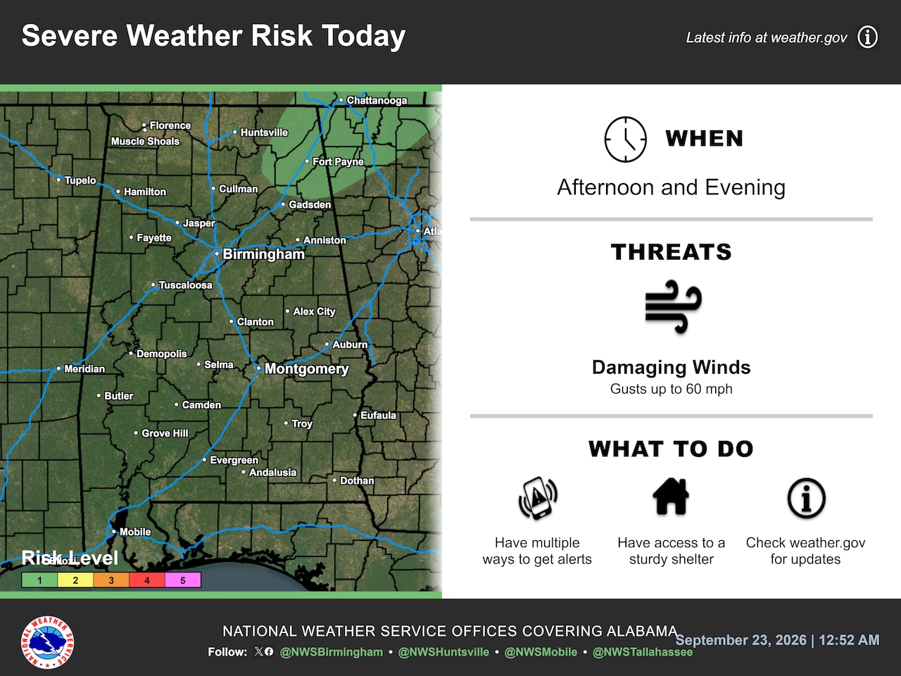
WeatherHighs in the upper 80s and 90s are expected on Wednesday in Alabama. Wednesday's forecast is shown above. But it will be cooler for much of the state on Thursday.National Weather ServiceAlabama’s much-anticipated “cool down” is expected to begin on Thursday, but Wednesday could bring a few more storms and still too-warm temperatures.The National Weather Service is forecasting a Level 1 out of 5 risk for severe weather for a small area in northeast Alabama today:A small area in northeast Alabama has a Level 1 out of 5 risk for severe weather on Wednesday. Storms will be most likely this afternoon and evening.National Weather ServiceA Level 1 risk means that isolated severe storms will be possible.Stronger storms could bring wind gusts as high as 60 mph, lightning and heavy rain.The weather service said the prime time for storms today will be from roughly 1 p.m. until 8 p.m.Rain chances will be highest in northeast Alabama today, with lower odds farther south. No rain is expected in western Alabama.Here is the forecast for rain chances today until 7 p.m.:Northeast Alabama will have higher rain chances today, while western Alabama may stay dry.NWSThe weather service in Huntsville was watching clouds over northern Alabama on Wednesday morning to see how they could affect temperatures today. If they end up hanging around it could keep northern Alabama temperatures a bit lower today.The rest of the state is expected to stay on the warmer side today. The weather service is forecasting high temperatures to continue to be above-average for Sept. 23, with highs expected to peak in the upper 80s in the north and east to lower 90s in the south and west. (See the Wednesday high temperature forecast at the top of this post.)A change coming on ThursdayDrier and slightly cooler air is expected to finally make it into parts of Alabama by Thursday, according to forecasters.High temperatures on Thursday -- while not chilly by any means -- will still be a welcome relief after a long heat wave last week.Eastern Alabama will get the full benefit. Western Alabama will still be warmer, but not as warm as today.Here are Thursday’s expected highs:Highs on Thursday will be much cooler compared with last week.NWSThursday’s temperatures will be much cooler compared with last week, when parts of the state had temperatures close to or at 100 degrees.Highs on Thursday will be closer to normal in eastern and north Alabama -- lower 80s.Southern and western Alabama will remain warm, but not as hot as last week. Highs will be in the mid-80s in western Alabama, and areas around Mobile could crack 90 degrees again.Look for similar temperatures to hang around Alabama through the weekend, according to the weather service. Leigh Morgan is an Alabama native. She has written about weather for AL.com since 2013 and has been a weather nerd since Hurricane Frederic slammed into the Alabama coast in 1979. She started out in journalism...
Cooler temperatures coming to Alabama -- after a few more storms
Full Article
Original Source
Read the full article at Al →KhanList aggregates and links to publicly available news content. We do not host full articles from third-party sources. Always verify important information with original sources.