
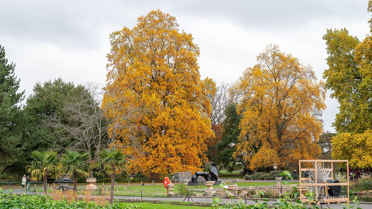
Published: 08:33 EDT, 3 November 2026 | Updated: 08:35 EDT, 3 November 2026 Britain is undergoing a return to 'anticyclonic gloom' this week as the country faces a miserable mixture of persistent grey skies, mist, fog and drizzle.The phenomenon can happen in autumn when a high pressure system settles over the country, resulting in a stable atmosphere that prevents vertical air movement.This setup traps moisture and low-level cloud, which blocks the normal combination that would disperse fog and allow the sunshine to break through the gloom.Instead of the warm and sunny weather that is associated with high pressure in the summer months, the UK gets stratus and stratocumulus clouds lingering for days.Light winds are not able to clear this cloud and the surface moisture condenses into fog and drizzle, while low sun angles have insufficient strength to burn through.All these factors result in dull and grey conditions lasting for days - particularly in inland areas and valleys where cold air pools and fog can become established.Forecasts for the next seven days show such conditions are expected until at least next Tuesday in much of the country, with temperatures staying very stable. Grey skies at Kew Gardens in London today as Britain faces the return of 'anticyclonic gloom' The Met Office forecast for London shows 'anticyclonic gloom' is expected for all of this weekLondon will have highs of 10C or 11C and lows of 7C to 8C every day over the next week, while Birmingham will reach 8C to 11C daily with lows of 5C to 6C.Met Office chief forecaster Paul Gunderson told the Daily Mail today: 'In summer, areas of high pressure often bring fine conditions, but in winter they can have a different character.'The still conditions can lead to mist, fog and cloud trapped under the high pressure developing in the absence of a strong breeze to move this still air through.'Areas of high pressure at any time of year can become persistent, but during the winter half of the year when they hang around they can lead to periods that some refer to as anticyclonic gloom where the conditions remain generally murky.'These periods often come to an abrupt end with the return of Atlantic-dominated weather with a strong westerly breeze.'The UK also saw a period of 'anticyclonic gloom' in October last year which resulted in the month being one of the country's dullest Octobers on record. A period of anticyclonic gloom in November 2024 lasted ten days - London is seen at the timeBut the most notable recent event was in November 2024, when a high pressure system over Europe locked in a stagnant air mass for more than ten days.Virtually no sunshine was recorded in many areas during this period and the atmosphere was saturated with mist, fog and drizzle despite mild temperatures.However, this gloom in the first half of the month was followed by a dramatic change, when two named storms – Bert and Conall – arrived in quick succession.Anticyclonic gloom is also known as 'Dunkelflaute' - a German word with no direct translation, but which roughly means 'dark doldrums' or 'dark wind lull'.At the end of last month, England was battered with heavy rain as Storms Austen and Boelo caused the country to have its wettest week since October 2024.But parts of the South West and Sussex remain officially in severe drought after an extremely dry period and the UK's hottest summer since records began in 1884.
Anticyclonic gloom is back! Weather phenomenon that covered Britain with grey skies returns as country faces week of mist, fog and drizzle
Full Article
Original Source
Read the full article at Dailymail →KhanList aggregates and links to publicly available news content. We do not host full articles from third-party sources. Always verify important information with original sources.