
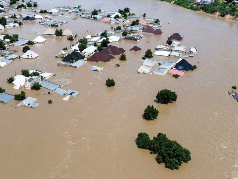
The Abuja Master Plan must not be subordinated to plot-allocation pressures, writes PAT ONUKWULI Abuja was conceived as the triumph of planning over disorder. Yet after recent deluges turned Wuse II, Maitama, Gudu, Lokogoma, Wuye and major arterial roads into temporary rivers, the capital faces a paradox: a city designed for order is producing hydrological chaos. This is not merely a drainage problem. It is a philosophy-of-development problem. Francis Bacon’s old admonition remains painfully relevant: “Nature, to be commanded, must be obeyed.” Abuja is experiencing the reverse. Where concrete is obeyed, water responds; where absorptive land becomes profitable plots, rainfall turns roads into channels. In Greek mythology, hubris was invariably followed by Nemesis. Urban planning has its own Nemesis: water remembers every natural path from which it has been expelled. Abuja’s flooding must be distinguished from Lagos’. Lagos is a low-lying coastal metropolis vulnerable to sea-level rise, land subsidence, storm surges and extreme rainfall. Abuja sits inland amid hills and rocky formations. Its risk differs. Intense rainfall descends rapidly from elevated terrain, gathers speed and becomes destructive runoff. Water from Mpape and the surrounding hills naturally flows towards lower ground through Maitama, Wuse and adjoining districts. Climate change exacerbates both problems in different ways. A warmer atmosphere holds more moisture, increasing the likelihood of intense downpours. Lagos must increasingly defend itself against water from the sea and the sky; Abuja must manage water moving from the sky to the hill, the hill to the valley, and the valley to the city. Nature had already provided part of the solution. Landscapes create wetlands, ponds, depressions, streams, floodplains and natural reservoirs that detain water, slow its flow and encourage percolation. Such spaces are often dismissed as “undeveloped” land, yet they perform valuable infrastructure functions. That is why the draining and conversion of the old Maitama Fisheries lake area for development warrants policy re-examination. Within the Mpape-Maitama-Wuse drainage corridor, any retention function it performed would have helped moderate upland run-off. Removing such storage was not merely a land-use decision; it could have altered the hydrological balance of the downstream area. Water denied a reservoir does not disappear. It relocates, usually downhill. Wuse II should therefore interpret recurring flooding not as an isolated inconvenience but as a warning from an altered watershed. The contradiction becomes sharper when Abuja’s extraordinary real-estate values are considered. Land in Maitama, Wuse II, Asokoro and adjoining districts commands enormous premiums. That value creates a powerful incentive to regard every open space, depression, green strip, watercourse and floodplain as a development opportunity. Higher land values intensify the temptation to convert ecological space into commercial and residential uses. At this point, Abuja’s flood problem is a governance issue. A parcel of land worth billions may seem more appealing than a wetland, retention basin or green corridor that generates no immediate revenue. But that calculation is dangerously narrow. An “unused” green area may prevent far greater losses from damaged property, broken roads, disrupted businesses and endangered lives. Land has market value, but it also has hydrological value. Extensive paving worsens the imbalance. Compounds, car parks, forecourts, walkways and commercial premises are increasingly sealed with concrete and interlocking stones. The result is a more expensive, less permeable city. Rainwater that would normally soak into the soil is forced onto roads, drains and adjoining properties. Abuja is, therefore, creating premium real estate while weakening the natural systems that protect it. The remedy cannot be another seasonal ritual of clearing drains after flooding. The FCT Administration requires a flood-resilience policy grounded in watershed science. First, waterways, floodplains, wetlands, retention basins and overland flow paths should be mapped, protected and closed to development pending hydrological assessment. Major projects should also comply with mandatory storm-water retention standards, using detention ponds, restored wetlands and landscaped basins where natural reservoirs have been lost. Third, Abuja needs a deliberate “sponge city” policy centred on green spaces, urban forests, bioswales, rain gardens, permeable pavements, and minimum soft-landscape requirements. If concrete accelerates run-off, greenery must absorb it. Fourth, development control must be uncompromising. High property values cannot override hydrology: a mansion on a floodplain remains on a floodplain, and no approval can repeal gravity. The Abuja Master Plan must be defended and intelligently updated, not subordinated to plot-allocation pressures. International Planning Associates prepared the citywide plan, and Kenzo Tange and URTEC later developed the Central Area urban design. The principle was clear: Abuja was intended to coexist with its landscape, not obliterate it. Enforcement against structures obstructing waterways is welcome, but bulldozers are emergency measures, not climate policy. The FCT administration must restore, reverse where necessary, and prevent. These floods may not mark the end of a wet season. They may signal the beginning of Abuja’s harsher climate reality. The choice is stark: Abuja can create room for water today, or water will create room for itself tomorrow. Nature may tolerate planning errors for a season; eventually, it enforces its own master plan. Dr. Onukwuli is a legal scholar and public affairs analyst. patonukwuli2003@yahoo.co.uk
ABUJA FLOODS: NATURE’S RECKONING
Full Article
Original Source
Read the full article at Thisdaylive →KhanList aggregates and links to publicly available news content. We do not host full articles from third-party sources. Always verify important information with original sources.