
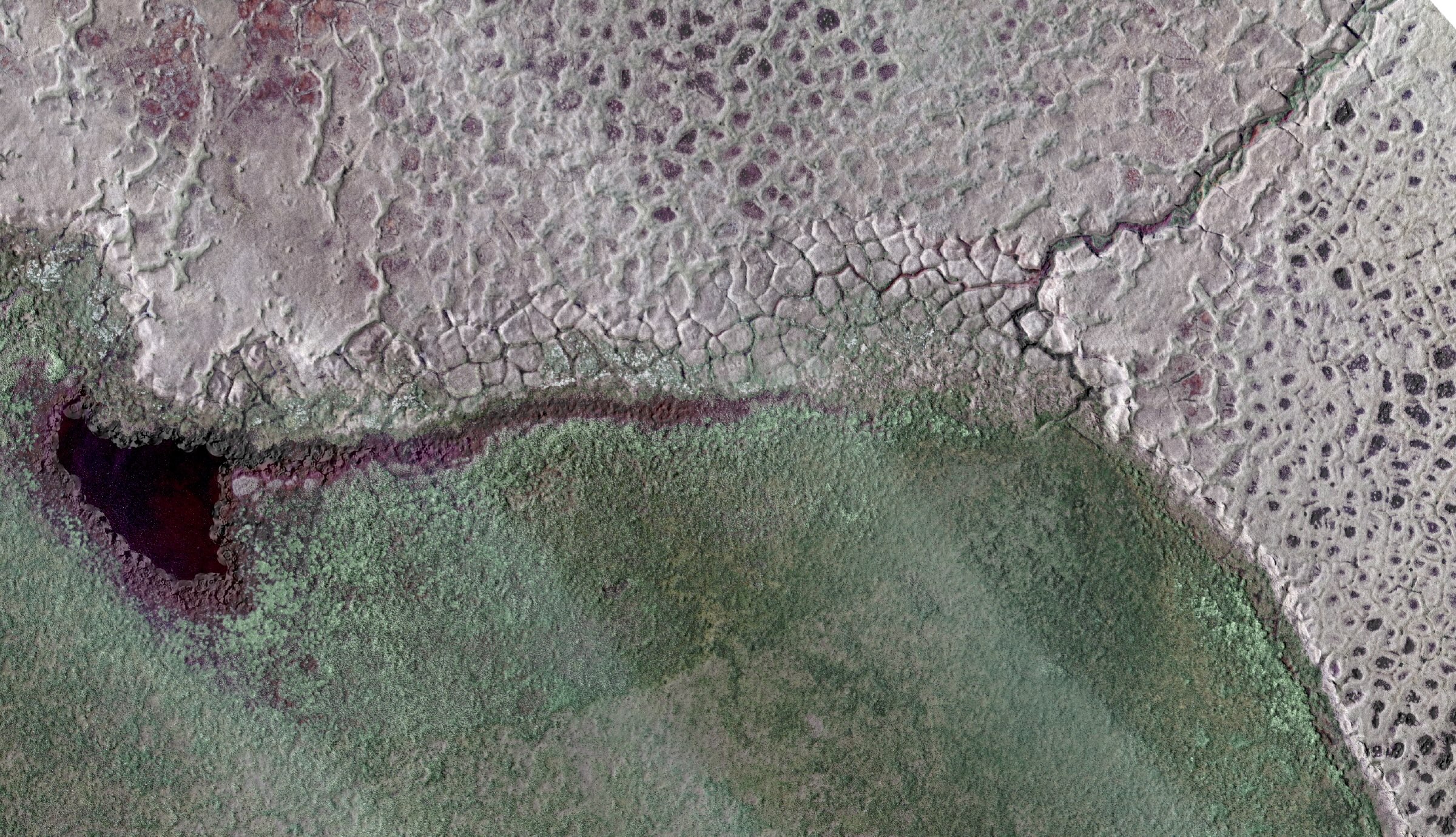
The Arctic is dotted with millions of lakes that sit on persistently frozen soil called permafrost. These lakes are crucial for the region’s wildlife and local communities. However, as temperatures rise, the permafrost thaws, which causes new lakes to form or existing lakes to abruptly disappear as lake water drains away through newly created channels. Researchers have now created an interactive map called Lost Lakes that allows people to monitor changes in around 4 million Arctic lakes in near real time. It can also show how the lakes have changed since 2016. Monitoring lake dynamics can offer important clues for the underlying permafrost, the researchers say. “LostLakes is completely free and designed to be used by experts and non-experts at the same time,” Ingmar Nitze, a remote sensing researcher at Germany’s Alfred Wegener Institute, which helped create the database, told Mongabay by email. Much of the Arctic’s ground sits on ice-rich permafrost. Over hundreds and thousands of years, this permafrost has accumulated massive amounts of carbon as plant, animal and microbe matter got trapped in the frozen soil. However, as the Arctic warms faster than the global average due to climate change, much of the region’s permafrost is thawing. “Once the permafrost thaws, some of this carbon, which was freeze-locked there for thousands of years, can go to the atmosphere and further fuel the warming, which may lead to a faster permafrost thaw,” Nitze said. Permafrost itself is challenging to monitor directly at large scale because it lies beneath the ground and researchers typically dig into it for measurements. However, the lakes, which often form or disappear with changes in the underlying permafrost, can be easily monitored by satellite imagery. When the ground temperature rises above freezing (0° Celsius, or 32° Fahrenheit), ice starts to thaw, causing the ground to sink and water to collect. This forms a pool, which over years and centuries can become a lake, Nitze said. “In west Alaska we have some ponds that started forming in the mid 20th century. Many Arctic lakes started forming around 12,000 years ago.” As more surrounding permafrost thaws, channels can appear through which water can drain out of lakes. In northwestern Alaska, for instance, nearly 200 lakes shrank in the summer of 2018, following an unusually warm winter, Nitze and Anna Liljedahl of the University of Alaska Fairbanks wrote in The Conversation. Arctic lake formation and drainage is a natural process. However, the number of lakes and speed at which they’re changing over time can indicate permafrost degradation, Nitze told Mongabay. Understanding permafrost can help communities as well: regions with more ice-rich permafrost may be more unstable and a bad choice for building sites, while regions with less ground ice could be safer, wrote Nitze and Liljedahl. Banner image: Aerial photograph of a lake that has recently drained, showing eroded ice wedge polygons and the outlet channel, top right. Image courtesy of Alfred Wegener Institute/Ingmar Nitze. Credits Topics
4 million lakes in ‘Lost Lakes’ map offer clues to Arctic permafrost
Full Article
Original Source
Read the full article at News →KhanList aggregates and links to publicly available news content. We do not host full articles from third-party sources. Always verify important information with original sources.